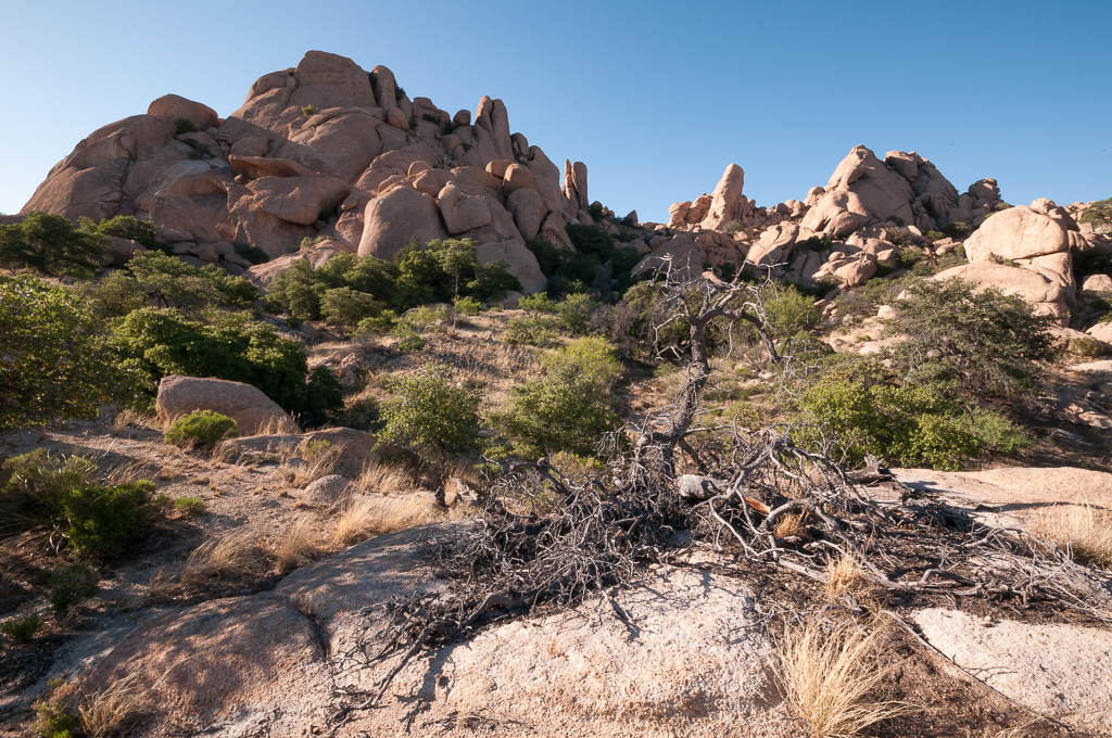
Texas Canyon is the high point of Interstate 10 in Arizona. The summit, just past the Texas Canyon Rest Area near milepost 320, sits at 4,974 feet, and the westbound lanes briefly cross above 5,000 feet (AARoads; Wikipedia, "Interstate 10 in Arizona"). The road climbs from the San Pedro Valley and Benson up into rocky Texas Canyon, threading between the Little Dragoon Mountains to the north and the Dragoon Mountains to the south, in Cochise County in the southeastern corner of the state.
If you are picturing a snow pass with chain-up areas, set that aside. This is a long, gradual ascent, not a steep mountain grade. Benson sits at about 3,585 feet, so the net rise to the summit is roughly 1,400 feet over about 20 miles east (Benson elevation: elevation.maplogs/DesertUSA; summit: AARoads). No state DOT publishes a grade percentage for it, so do not expect one. Arizona has no chain-control system, and there is no designated chain-up or brake-check area here.
The hazard that actually strands truckers on this part of I-10 is blowing dust, and it hits east of the summit. Between Willcox and the New Mexico line, around San Simon and Bowie, strong winds kick up dust that can drop visibility to nothing. ADOT has closed 60-plus miles of I-10 in both directions during dust events, with detours running 100-plus miles via Safford and Duncan (tucson.com; weather.com). Texas Canyon itself is also a DPS-named serious-crash hot spot, where the road curves past jumbles of boulders at the north end of the Dragoon Mountains.
- Texas Summit is the highest point of I-10 in Arizona at 4,974 feet, just past the Texas Canyon Rest Area near milepost 320; westbound lanes briefly top 5,000 feet (AARoads; Wikipedia, Interstate 10 in Arizona)
- The climb is a long, gradual rise of about 1,400 feet from Benson (~3,585 ft) over roughly 20 miles, not a steep mountain grade (Benson elevation: elevation.maplogs/DesertUSA)
- No state-DOT grade percentage was found for Texas Canyon; Mountain Directory has no entry for it, so no specific grade is published here
- Arizona has no chain-control system and no chain-up law; there is no designated chain-up or brake-check area at Texas Canyon (AZ MVD rules summary)
- The Texas Canyon Rest Area (about MP 320, both directions, ~70 mi east of Tucson) has truck parking covered by ADOT's Truck Parking Availability System, with live counts on AZ511 (ADOT TPAS project page)
- A June 19, 2017 dust storm near Lordsburg, NM caused a 25-vehicle pileup that killed 6 (abc15.com)
- An April 26, 2016 dust event near San Simon closed 62 miles of I-10, with gusts reported near 45 mph (weather.com)