← All passes
Mountain pass No. 73 Open

Flagstaff Summit

On I-40 the high point west of Flagstaff is signed as the Arizona Divide, near milepost 190, about 5 miles west of downtown Flagstaff. It sits at 7,335 feet (ADOT; theroute-66.com), and that number matters: it is the highest point on the entire length of I-40, across all eight st

7,335Elevation (ft)
2,236Metres
I-40Route
AZState
Interstate 40 westbound near Flagstaff, Arizona, where the highway climbs through the high country toward the San Francisco Peaks.
Interstate 40 westbound near Flagstaff, Arizona, where the highway climbs through the high country toward the San Francisco Peaks.Nicholas (Flickr user, Pennsylvania, USA) / Wikimedia Commons · CC BY
00 Live conditions
Open
Road
Unknown
Northbound
No restrictions
Southbound
No restrictions

Reported Jun 2, 2026, 11:23 PM MT. Conditions change fast at elevation; confirm with the DOT before you commit.

01 Overview

On I-40 the high point west of Flagstaff is signed as the Arizona Divide, near milepost 190, about 5 miles west of downtown Flagstaff. It sits at 7,335 feet (ADOT; theroute-66.com), and that number matters: it is the highest point on the entire length of I-40, across all eight states. Wikipedia's I-40 route description puts it at "just over 7,330 feet" and notes it is higher than the Continental Divide crossing in New Mexico at 7,275 feet. At this spot, ADOT explains, water either runs north or northwest toward the Colorado River watershed or south or southwest toward the Gila River watershed.

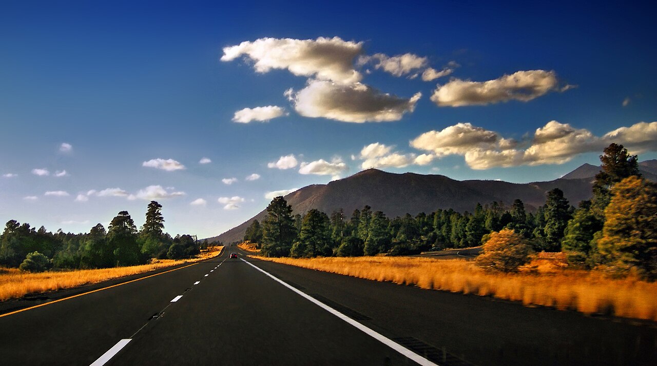
People hear "Arizona" and think desert. This corridor does not behave like one. Flagstaff sits near 7,000 feet in pine forest in and near the Coconino National Forest, and the high country here catches heavy mountain snow. Flagstaff averages roughly 100 inches a year (NWS Flagstaff / NOAA WR-273), most of it in January and February. Because the Arizona Divide is the highest point on all of I-40, this stretch takes the worst of the winter weather, and ADOT closes the highway storm by storm when conditions go bad.

The grade that earns the most respect is not the climb to the divide but Ash Fork Hill to the west, where I-40 westbound drops off the high country toward Ash Fork. East-side truck stops sit around Holbrook and Winslow; west-side facilities are at Williams and Ash Fork. At Flagstaff, I-17 branches south and falls roughly 6,000 feet over about 140 miles toward Phoenix, which the RMS corridor guide calls one of the most significant grade descents in the national highway system. Plan fuel, brakes, and weather before you reach the top.

  • The Arizona Divide near milepost 190 is the highest point on all of I-40, signed at 7,335 ft (ADOT; theroute-66.com), higher than the Continental Divide crossing in New Mexico at 7,275 ft (Wikipedia)
  • The summit sits about 5 miles west of downtown Flagstaff on I-40 (ADOT)
  • Ash Fork Hill westbound (roughly MP 146-152) runs about 6% over 6 miles with a brake-check area and "use lower gear" signs (Mountain Directory; AARoads)
  • Flagstaff averages roughly 100 inches of snow a year, mostly January and February (NWS Flagstaff / NOAA WR-273)
  • Record snow season was about 210 inches in winter 1972-73 (NOAA WR-273)
  • Arizona has no fixed chain-control season or numbered levels; chains or 4WD are required only when ADOT posts them during a storm (AZ chain-law references; RMS)
  • At Flagstaff, I-17 branches south and drops about 6,000 ft over roughly 140 miles toward Phoenix (RMS)
02 Chain controls & closures

Arizona does not run a formal numbered chain-control system or a fixed chain season the way California and Colorado do. There is no level scale and no set start or end date. Chains or 4WD are required only when ADOT posts "Chains or 4WD Required" or "Chains or Snow Tires Required" during an active storm, and Arizona DPS enforces it at the scene. When a road is posted that chains are required, you either chain up or stop until the posting comes down. In practice the heavy snow risk at this elevation runs roughly October through April (RMS), so carry chains through those months. The posting closes when the storm passes and ADOT lifts it, not on a calendar.

03 Notable hazards
Hazard

Heavy mountain snow

Flagstaff averages roughly 100 inches of snow a year, most of it in January and February (NWS Flagstaff / NOAA WR-273). The Arizona Divide is the highest point on all of I-40, so this corridor catches the worst of it. The record season ran about 210 inches in winter 1972-73 (NOAA WR-273).

Hazard

Brake-management grade on Ash Fork Hill (westbound)

Coming off the high country toward Ash Fork (roughly MP 146-152), I-40 westbound drops about 6% over 6 miles. The first two miles are 6%, then about 1.5 miles of 4-5%, then another 1.5 miles of 6% (Mountain Directory). There is a brake-check area and signs reading "check brakes and equipment, use lower gear" (Mountain Directory; AARoads).

Hazard

High wind and blowing dust

Gusts reach about 50 mph on I-40 and up to 70 mph east of Flagstaff. High-profile vehicles are warned and have been blown over, and ADOT closes segments for near-zero visibility, such as MP 230-252 in the Little Colorado River Valley (ADOT travel bulletins; NWS High Wind Warnings).

Hazard

Ice, snow-pack, and limited visibility, October through April

This is mountain terrain with real winter conditions: chain postings when ADOT calls for them, snow-packed lanes, and limited visibility through the cold months (RMS).

Hazard

Slide-offs and multi-hour backups in storms

In a March 2025 storm, Flagstaff got about 20 inches and Williams about 28 inches, and ADOT reported a 15-plus mile backup from slide-offs and crashes. Drivers were stranded overnight, and one Albuquerque to Las Vegas trip took 26 hours instead of about 8.5 (ABC15).

04 History

Route 66 was realigned in 1942 so the Arizona Divide, now I-40 Exit 190, became the high point of the route west of Flagstaff (theroute-66.com). The interstate came later. ADOT and Wikipedia record that the I-40 bypass around Flagstaff was completed in 1968 with three interchanges, replacing the old US 66 routing through town, and the final section of I-40 in Arizona opened near Williams in 1984, the last stretch of the interstate to be built in the state.

The grade off the high country has been a problem far longer than the interstate. AARoads notes that "Ash Fork Hill has always been a problem for road builders," dating back to the early road and Route 66 eras. The weather has its own record. From December 13 to 20, 1967, about 84.6 inches of snow fell on Flagstaff, with 83 inches on the ground, and the city was shut down for over a week (NWS Flagstaff / NOAA WR-273). That gives you a sense of how hard this corridor can get hit.

05 FAQ
What's the highest point on I-40, and where is it?
The Arizona Divide, near milepost 190, about 5 miles west of Flagstaff. It is signed at 7,335 feet (Wikipedia puts it at just over 7,330), and it is the highest point on all of I-40, higher than the Continental Divide crossing in New Mexico at 7,275 feet.
Where do I need to watch my brakes?
The grade to watch is Ash Fork Hill on I-40 westbound, roughly milepost 146 to 152. It runs about 6% over 6 miles with a brake-check area and "use lower gear" signs (Mountain Directory; AARoads). Gear down before you start the descent, not partway through it.
Do I need chains on I-40 at Flagstaff?
Only when ADOT posts them. Arizona has no fixed chain-control season and no numbered levels. Chains or 4WD are required when ADOT puts up a "Chains or 4WD Required" sign during a storm, and Arizona DPS enforces it at the scene. Carry chains October through April so you have them when a storm hits.
Does I-40 actually close at Flagstaff in winter?
Yes, storm by storm, with no set schedule. Recent examples include a February 20, 2026 closure (eastbound at the US 93 junction, westbound at MP 224), a January 8, 2026 closure near Williams from jackknifed semis, and a March 2025 storm (Flagstaff about 20 inches, Williams about 28 inches) that stranded drivers overnight. Check AZ511 or azdot.gov before you go.
How much snow does this stretch get?
Flagstaff averages roughly 100 inches a year, mostly in January and February, and the record season was about 210 inches in 1972-73 (NWS Flagstaff / NOAA WR-273). Because the Arizona Divide is the highest point on I-40, this corridor catches the worst of it.
It's a desert, so is wind really a problem here?
Yes. East of Flagstaff, toward Winslow, I-40 gets blowing dust and crosswinds in the 50 to 70 mph range. High-profile vehicles are warned and have been blown over, and ADOT closes segments such as MP 230 to 252 when visibility drops to near zero (ADOT bulletins; NWS High Wind Warnings).
06 Related routes

Flagstaff Summit on the live map

See conditions, incidents, and weather around Flagstaff Summit in real time.

Open Live Map