← All passes
Mountain pass No. 47 Chains

Mountain Pass

Mountain Pass is the highest point on I-15 between California and Nevada. The summit sits at 4,730 ft in San Bernardino County, about 15 miles southwest of the state line, where the Nevada side begins at the casino town of Primm. The name does double duty here. It is the literal

4,730Elevation (ft)
1,442Metres
I-15Route
CAState
Interstate 15 drops down from Mountain Pass into the Ivanpah Valley near the California-Nevada line, the high point of the route at about 4,730 feet.
Interstate 15 drops down from Mountain Pass into the Ivanpah Valley near the California-Nevada line, the high point of the route at about 4,730 feet.Stan Shebs / Wikimedia Commons · CC BY-SA
00 Live conditions
Chains
Temperature
170°F
Road
Wet
Weather
Heavy Snow
Northbound
Carry Chains
Southbound
Carry Chains

Reported Apr 16, 2026, 7:31 AM MT. Conditions change fast at elevation; confirm with the DOT before you commit.

01 Overview

Mountain Pass is the highest point on I-15 between California and Nevada. The summit sits at 4,730 ft in San Bernardino County, about 15 miles southwest of the state line, where the Nevada side begins at the casino town of Primm. The name does double duty here. It is the literal I-15 summit and also an unincorporated community, home to the Mountain Pass rare-earth mine.

For a trucker, this is a brake grade more than a snow grade, though it is both. Northbound, the freeway drops off the summit into the Ivanpah Valley toward Primm, a downgrade that runs about ten miles before it flattens near Yates Well Road. The grade is roughly 6% for that stretch (Gribblenation, April 2021), which is the best available figure rather than a posted Caltrans spec. A runaway truck ramp is set up for northbound traffic near the dry Ivanpah lakebed.

The pass has no fixed seasonal closure. It is open year-round and shuts only when a winter storm puts snow and ice on the summit, usually for hours, occasionally overnight. When that happens, Caltrans District 8 and the CHP close I-15 between Baker and Primm, then reopen it with escort convoys through the worst of it. Real-time status comes from Caltrans QuickMap or the road hotline at 1-800-427-7623.

  • Summit elevation 4,730 ft, the highest point on I-15 between California and Nevada (Wikipedia: Interstate 15 in California)
  • Located in San Bernardino County, about 15 miles southwest of the Nevada state line; Primm, NV sits on the Nevada side (Wikipedia: Interstate 15 in California)
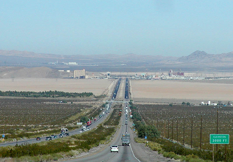
  • Northbound descent into the Ivanpah Valley lasts about 10 miles down to Yates Well Road, Exit 291 (AARoads: I-15 North, Barstow to Nevada)
  • Grade on that descent is roughly 6% (Gribblenation, April 2021); no official Caltrans grade spec was found, so treat this as an attributed estimate
  • Runaway truck ramp is provided for northbound traffic near the dry Ivanpah lakebed (AARoads)
  • No fixed seasonal closure; the pass closes ad hoc during snow and ice, with documented closures in Dec 2019, Feb 2023, and Feb 2026 (Review-Journal; VVNG; Fox5 Vegas)
  • Annual precipitation at the Mountain Pass community averages 8.36 in, wettest in July and August (Western Regional Climate Center, via Wikipedia)
02 Chain controls & closures

There is no chain-control season on this pass in the way the Sierra passes have one, and no posted closing date. Mountain Pass stays open year-round. California's three-tier chain system can apply in any snow event: R-1 (chains on all vehicles except passenger cars and light trucks under 6,000 lb GVW running snow tires on two drive wheels), R-2 (chains except 4WD under 6,500 lb with snow tires on all four), and R-3 (chains on everything, no exceptions). On this stretch, though, the documented Caltrans and CHP response to ice has been full closure and escort convoys rather than a posted chain-up area. No named chain-up area or chain-control mile marker for Mountain Pass was verifiable. The road closes only when a storm hits and reopens once crews clear the ice, usually within hours. Check Caltrans QuickMap or call 1-800-427-7623 before you run it in winter.

03 Notable hazards
Hazard

Winter ice closes the pass

At 4,730 ft the summit collects snow and ice that repeatedly triggers full closures and CHP escort convoys, as in December 2019, February 2023, and February 2026. Caltrans has reported clearing up to three feet of snow and ice from affected I-15 stretches during major storms (Las Vegas Review-Journal; VVNG; Fox5 Vegas; KTNV on Caltrans snow removal).

Hazard

10-mile descent into Ivanpah Valley

Northbound, the road drops about 6% for roughly ten miles from the summit toward Yates Well and Nipton. It is a brake-management grade. A runaway truck ramp is provided for northbound traffic near the dry Ivanpah lakebed, placed about four miles ahead of Exit 281 at Bailey Road (AARoads; Wikipedia; grade % from Gribblenation).

Hazard

Crosswinds and dust on the open desert grade

NWS Las Vegas has issued High Wind Warnings for this corridor with northwest winds of 25 to 35 mph, gusts of 50 to 60 mph, and isolated gusts near 70 mph in wind-prone higher elevations. High-profile vehicles like semis, RVs, and trailers face severe crosswinds, and blowing desert dust near Primm can drop visibility fast (NWS Las Vegas; 8 News Now).

Hazard

Whiteout and dust-out closures

Low visibility alone can close the road. The February 2023 closure was explicitly tied to weather-reduced roadway visibility before icy conditions set in (VVNG, citing Caltrans District 8).

Hazard

Summer monsoon thunderstorms

The wettest months at Mountain Pass are July and August, with frequent thunderstorms. The community averages 8.36 in of precipitation a year (Western Regional Climate Center, via Wikipedia).

04 History

The Barstow-to-Nevada alignment, then US 91/466, was kept as a planned Interstate after the Federal-Aid Highway Act of June 29, 1956. The Mountain Pass segment itself was brought up to freeway standard in October 1963, when the road opened to freeway standards from Cima Road northeast to the Nevada state line. The wider corridor came together in pieces: the 25-mile "Baker Grade" segment from eastern Baker to Halloran Summit was finished in 1961, and I-15 north of Barstow was announced complete to freeway standards in 1965. These 1961, 1963, and 1965 dates trace to Gribblenation, a well-sourced roadgeek site citing period California Highways and Public Works, not a state DOT page directly.

More recently, Caltrans rebuilt I-15 from Devore to Nevada starting in 2002 at a cost of about $349 million, with most of the work done by winter 2009 (Wikipedia: Interstate 15 in California). The Mountain Pass community is now dominated by its rare-earth mine, owned by MP Materials since July 2017, which has produced a large share of the world's rare-earth output.

05 FAQ
Does I-15 at Mountain Pass close in winter?
There is no fixed seasonal closure. It closes ad hoc during snow and ice storms, usually for hours and occasionally overnight, then reopens with CHP escort convoys. Documented closures hit in December 2019, February 2023, and February 2026.
How high is Mountain Pass on I-15?
The summit is 4,730 ft, the highest point on I-15 between California and Nevada (Wikipedia: Interstate 15 in California).
How steep and long is the downgrade toward Primm and Las Vegas?
Northbound it runs roughly 6% for about ten miles from the summit down into the Ivanpah Valley near Yates Well and Nipton. There is a runaway truck ramp for northbound traffic near the dry Ivanpah lakebed. The grade figure comes from Gribblenation, not an official Caltrans spec, so treat it as approximate.
Are chains ever required?
Chains can be required under California's R-1, R-2, and R-3 system in any snow event. On this stretch, though, the usual DOT response to ice has been closure plus CHP escort rather than a posted chain-up area, and no named chain-up location for Mountain Pass was verifiable. Check Caltrans QuickMap or call 1-800-427-7623.
What is the wind like for a high-profile truck?
NWS Las Vegas issues High Wind Warnings here with gusts of 50 to 60 mph and isolated gusts near 70 mph, plus blowing dust near Primm that can blind visibility. Crosswinds are a documented hazard for semis on this part of I-15 (NWS Las Vegas; 8 News Now).
Where do the storm closures start and stop?
Closures are typically described as running between Baker, CA and Primm, NV, which on the California side covers the stretch from Nipton Road to the state line. CHP has staged escort convoys out of Halloran Springs (VVNG 2023; Review-Journal 2019).
06 Related routes

Mountain Pass on the live map

See conditions, incidents, and weather around Mountain Pass in real time.

Open Live Map