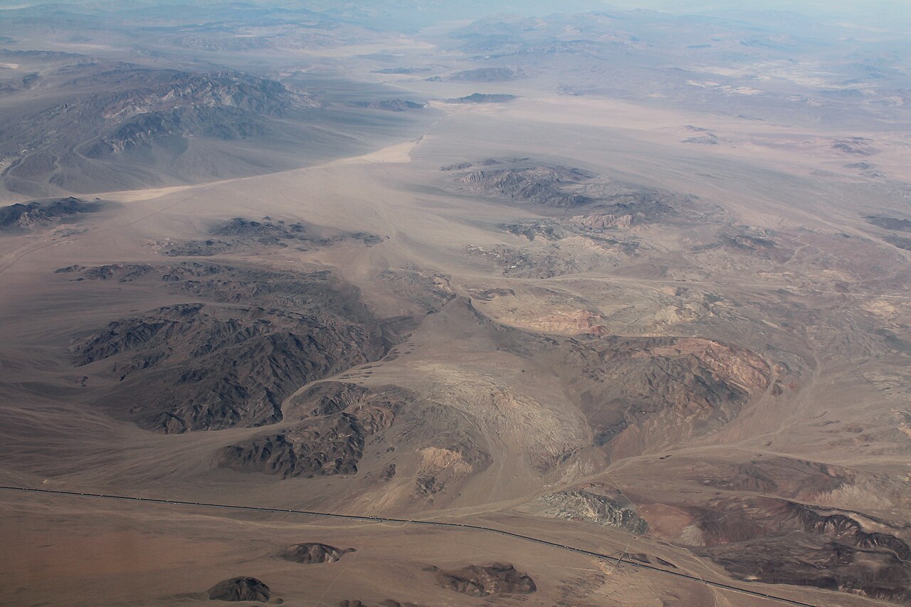
Halloran Summit sits on Interstate 15 in San Bernardino County, out in the Mojave Desert northeast of Baker, California. This is the main truck route between the Los Angeles basin and Las Vegas, so most of the freight that runs that lane crosses here. The summit road is Exit 265. Halloran Springs Road is Exit 259, and Cima Road, which gets you into Shadow Valley and the Mojave National Preserve, is Exit 272.
The elevation depends on which source you read. Wikipedia and AARoads put it at "over 4,000 feet." FoxRVTravel lists 4,700 feet. The honest answer is somewhere around 4,600 to 4,700 feet. One thing to keep straight: this is not the same as Mountain Pass, a separate and slightly higher summit at about 4,730 feet farther northeast toward the Nevada line. Several writeups blend the two, and they are different climbs.
What makes drivers pay attention here is the grade and the isolation. The I-15 grade in this stretch runs up to 6%. Eastbound you climb roughly 6% for about 10 miles cresting toward the summit. Westbound and southbound toward Baker the descent is gentle for the first couple of miles, then steepens to as much as 6% for around 17 miles, dropping from the high desert plateau down to Baker at roughly 930 feet. That is a fall of well over 3,000 feet, and there is not much out here between services. Add open-desert crosswinds, blowing dust off the dry playas, and the occasional winter snow event, and you have a corridor that demands cool brakes and a full tank.
- Halloran Summit is on I-15 in San Bernardino County, Mojave Desert, northeast of Baker, CA; the summit road is Exit 265 (AARoads; Wikipedia)
- Summit elevation is roughly 4,600 to 4,700 ft; sources say "over 4,000 ft" (Wikipedia/AARoads) and 4,700 ft (FoxRVTravel)
- The grade reaches up to 6%, about 10 miles climbing eastbound and up to 17 miles on the descent toward Baker (FoxRVTravel; gribblenation)
- The corridor drops from the high point to about 930 ft at Baker, well over 3,000 ft of descent (AARoads; gribblenation cites near 900 ft)
- I-15 adds a third truck climbing lane up Halloran Summit between Exit 247 and Exit 265 (AARoads)
- This is the main freight route between the LA basin and Las Vegas/Primm; about 45 miles of isolated desert lies between Baker and Primm, NV (AARoads)
- Do not confuse it with Mountain Pass, a separate summit at about 4,730 ft farther northeast (AARoads)