← All Interstates
Interstate No. 15 36 live incidents

I-15: The CANAMEX Trade Corridor

Interstate 15 is the main north-south freight route of the Mountain West, running 1,433 miles from San Diego, California to Sweet Grass, Montana on the Canadian border. It is the longest north-south interstate west of the Rockies and the designated US segment of the CANAMEX trade…

36Incidents
4Alerts in its states
6States
9Passes
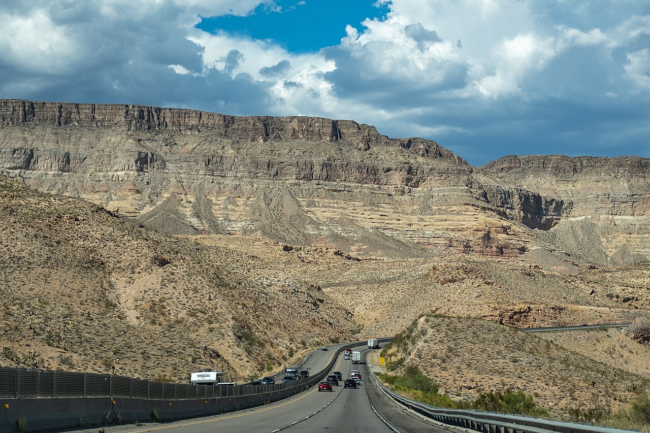
I-15 winding through the Virgin River Gorge in Arizona
I-15 winding through the Virgin River Gorge in Arizona Han Zheng / Wikimedia Commons · CC BY-SA 2.0
01 Route overview

Interstate 15 is the main north-south freight route of the Mountain West, running 1,433 miles from San Diego, California to Sweet Grass, Montana on the Canadian border. It is the longest north-south interstate west of the Rockies and the designated US segment of the CANAMEX trade corridor connecting Mexico and Canada through the western interior. The route ties Southern California's logistics hubs to Las Vegas, Salt Lake City, and the agricultural and energy economies of Idaho and Montana.

The geography is dramatic. From the San Diego coast, I-15 climbs through the Cajon Pass (4,190 ft), the gateway between the LA Basin and the Mojave Desert, then descends to Las Vegas, climbs again across the Virgin River Gorge in Arizona's narrow corner, and continues over high desert to Salt Lake City. North of Salt Lake it threads the Wasatch Front, climbs Monida Pass (6,870 ft) on the Idaho-Montana border, and rolls across high Montana plains to the international crossing at Sweet Grass.

I-15 is one of the highest-volume freight corridors in the West, especially the segment between Barstow and Las Vegas, which carries a continuous stream of containers and produce trucks. Holiday weekends produce notorious traffic jams between Las Vegas and the LA Basin, backups of 20+ miles are routine on Sunday evenings. Winter chain controls are common in the Cajon, Virgin River Gorge, and Monida Pass segments.

  • Longest north-south interstate west of the Rocky Mountains
  • Designated CANAMEX trade corridor between Mexico and Canada
  • Crosses six states: CA, NV, AZ (29 miles only), UT, ID, MT
  • Cajon Pass (4,190 ft) is the primary truck route between LA and the Mojave
  • Virgin River Gorge in AZ is one of the most expensive interstate sections ever built (per mile)
  • Monida Pass (6,870 ft) on the ID/MT border is closed regularly in winter
  • Carries the bulk of LA→Las Vegas freight and weekend recreational traffic
02 Key cities & junctions
StateMileCity / Junction
CA MM 0 San Diego (I-5 jct)
CA MM 50 Temecula
CA MM 96 Riverside
CA MM 113 San Bernardino (I-10 jct)
CA MM 138 Cajon Summit
CA MM 184 Barstow (I-40 jct)
CA MM 293 Baker
NV MM 41 Las Vegas (I-215 jct)
NV MM 122 Mesquite
AZ MM 18 Virgin River Gorge
UT MM 8 St. George
UT MM 132 Beaver
UT MM 222 Spanish Fork / Provo
UT MM 305 Salt Lake City (I-80 jct)
UT MM 351 Ogden
ID MM 31 Pocatello
ID MM 119 Idaho Falls
ID MM 184 Monida Pass / MT border
MT MM 62 Dillon
MT MM 121 Butte (I-90 jct)
MT MM 219 Helena (US-12 jct)
MT MM 314 Great Falls
MT MM 397 Sweet Grass / Canadian Border
03 Mountain passes & summits
OPEN 51°F

Homestake Pass (I-15)

Dry · 51°F, Dry

NB · No restrictions
SB · No restrictions

OPEN 72°F

I-15 Beaver Ridge

Dry · 72°F, wind 13 mph S

NB · No restrictions
SB · No restrictions

OPEN 74°F

I-15 Black Ridge

Dry · 74°F, wind 13 mph S

NB · No restrictions
SB · No restrictions

OPEN 73°F

I-15 Dog Valley Pass

Dry · 73°F, wind 23 mph S

NB · No restrictions
SB · No restrictions

OPEN 71°F

I-15 Pine Creek Summit

Dry · 71°F, wind 16 mph S

NB · No restrictions
SB · No restrictions

OPEN 75°F

I-15 Point of the Mountain

Dry · 75°F, wind 18 mph SE

NB · No restrictions
SB · No restrictions

OPEN 72°F

I-15 Scipio Summit

Dry · 72°F, wind 20 mph SW

NB · No restrictions
SB · No restrictions

OPEN N/A

Malad (I-15)

No data

NB · No restrictions
SB · No restrictions

Pass conditions & guide →
OPEN 61°F

Monida Pass (I-15)

Dry

NB · No restrictions
SB · No restrictions

Pass conditions & guide →

All US mountain pass conditions →

04 Notable hazards & trouble spots
Hazard

Steep grade, brake fires, and chronic congestion

Cajon Pass, CA (MM 130-145)

A 6% sustained grade for over 7 miles connecting the LA Basin to the Mojave. Brake fires on heavy trucks descending southbound are routine; runaway-truck ramps near Kenwood Avenue and Cleghorn Pass see regular use. Sunday evening backups returning from Las Vegas can stretch 20+ miles.

Hazard

Narrow canyon with no shoulders or bypass

Virgin River Gorge, AZ (MM 12-29)

The 29-mile Arizona segment of I-15 threads a narrow canyon with limited shoulders, blind curves, and a notoriously rough deck on the river bridges. Any incident closes the corridor entirely. There is no practical alternate, and a closure can divert all traffic onto a 200-mile detour through Cedar City and Hurricane.

Hazard

High-elevation pass with frequent winter closures

Monida Pass, ID/MT (MM 184 ID - 0 MT)

At 6,870 ft, Monida Pass is the highest point on I-15. Idaho ITD and Montana MDT close the pass regularly in winter for blowing snow and ice. There is no parallel alternate; trucks shut down at Idaho Falls or Dillon and wait it out.

Hazard

Heat, breakdowns, and limited services

Mojave Desert (MM 184 CA - 41 NV)

The 200-mile stretch between Barstow and Las Vegas crosses the Mojave with summer pavement temperatures over 130°F. Tire blowouts and overheating are common, and services thin out between Baker and Primm. Carry extra water and know your tire condition before heading east in summer.

Hazard

Dense urban interchange with frequent HAZMAT restrictions

Salt Lake City stack (MM 305-313)

Where I-15, I-80, and I-215 converge in central Salt Lake City is one of the busiest stack interchanges in the Mountain West. UDOT enforces seasonal HAZMAT routing and the area sees heavy fog and inversion conditions in winter.

4a Passes and chain laws on this route

The passes on Interstate 15 with a full guide: grade, chain-control season, closures and hazards. The status is the state DOT's latest reading.

Chain rules for the states these passes are in, and for every state on the route that has a chain law:

All US mountain pass conditions →

05 Active incidents (36)
CONSTRUCTION MT

Road Work

I-15

CONSTRUCTION MT

Road Work

I-15

CONSTRUCTION MT

Road Work

I-15

CONSTRUCTION MT

Road Work

I-15

CONSTRUCTION MT

Road Work

I-15

CONSTRUCTION MT

Road Work

I-15

CONSTRUCTION ID

Work on the shoulder on I-15 Northbound from MM (181) to MM (182). 9/21/2026 8:00 AM MT to 9/30/2026 10:35 PM…

I-15

CONSTRUCTION ID

Work on the shoulder on I-15 Northbound from MM (181) to MM (182). 9/21/2026 8:00 AM MT to 9/30/2026 10:35 PM…

I-15

CONSTRUCTION ID

Work on the shoulder on I-15 Northbound from MM (181) to MM (182). 9/21/2026 8:00 AM MT to 9/30/2026 10:35 PM…

I-15

CLOSURE ID

Bridge construction on I-15-BL Both Directions from Commercial St to Willow Ln. All lanes closed. 9/14/2026 7:…

I-15-BL

CLOSURE ID

Bridge construction on I-15-BL Both Directions from Commercial St to Willow Ln. All lanes closed. 9/14/2026 7:…

I-15-BL

CONSTRUCTION ID

Bridge construction on I-15 Both Directions from MM (88) to MM (92). 5/11/2026 6:00 AM MT to 11/3/2026 4:00 PM…

I-15

CONSTRUCTION ID

Bridge construction on I-15 Both Directions from MM (88) to MM (92). 5/11/2026 6:00 AM MT to 11/3/2026 4:00 PM…

I-15

CONSTRUCTION ID

Long term road construction on I-15 Both Directions from Inkom to Portneuf River. 3/2/2026 7:00 PM to 10/31/20…

I-15

CONSTRUCTION ID

Long term road construction on I-15 from MM (77) to MM (80). 12/3/2024 7:13 AM to 6/1/2027 6:00 PM Mon, Tue, W…

I-15

CONSTRUCTION ID

roadwork

I-15

CONSTRUCTION ID

closures

I-15-BL

CONSTRUCTION ID

roadwork

I-15

Showing 18 of 36. View all on map →

06 Weather alerts in its states (4)

National Weather Service alerts in force in the states Interstate 15 runs through. Each one covers a county or a forecast zone, which may be far from the Interstate.

  • 2 alerts in California: Lake Wind Advisory
  • 1 alert in Utah: Hydrologic Outlook
  • 1 alert in Montana: Special Weather Statement

See where each alert is on the live map →

07 FAQ
How long does it take to drive I-15 end to end?
A passenger car can cover the 1,433 miles in 22-25 hours of driving time. Commercial drivers respecting hours-of-service rules typically need 3 to 4 days, with mandatory rest breaks and weather-related delays in winter.
Does I-15 close in winter?
Yes. Monida Pass on the Idaho/Montana border closes several times per winter for blowing snow, the Cajon Pass closes for occasional snow events, and the Virgin River Gorge closes whenever there is an incident due to the lack of alternates. Real-time status is published by Caltrans, NDOT, ADOT, UDOT, ITD, and MDT.
How long is the drive from Los Angeles to Las Vegas on I-15?
The drive from downtown Los Angeles to the Las Vegas Strip on I-15 is approximately 270 miles. Expect 4-5 hours under good conditions; Sunday evening eastbound returns regularly take 6-8 hours due to Cajon Pass congestion and accidents in the Mojave segment.
Is I-15 a toll road?
No. I-15 itself is toll-free for its entire 1,433-mile length. Optional adjacent express lanes (the I-15 Express Lanes in Riverside County and San Diego County) carry tolls, but the general-purpose lanes are free.
What is the highest point on I-15?
Monida Pass at 6,870 ft on the Idaho-Montana border is the highest elevation on I-15. The summit is in a remote stretch with no services for miles in either direction.

Interstate 15 Live Map

See every incident, alert, and road condition on Interstate 15 in real time.

Open Live Map