← All passes
Mountain pass No. 68 No live data

Monida Pass

Monida Pass carries Interstate 15, signed the Veterans Memorial Highway, across the Continental Divide right at the Idaho-Montana state line. It runs between Spencer and Humphrey on the Idaho side (Clark County) and Lima and Monida on the Montana side (Beaverhead County). Here th

6,823Elevation (ft)
2,080Metres
I-15Route
MT/IDState
Golden autumn aspens below the Centennial Mountains near Monida Pass, the Continental Divide crossing on I-15 at the Idaho-Montana line.
Golden autumn aspens below the Centennial Mountains near Monida Pass, the Continental Divide crossing on I-15 at the Idaho-Montana line.U.S. Fish and Wildlife Service (Red Rock Lakes NWR) · Public domain
00 Live conditions
No live data
No live condition feed for this pass right now. Check the state DOT or 511 before you climb.
01 Overview

Monida Pass carries Interstate 15, signed the Veterans Memorial Highway, across the Continental Divide right at the Idaho-Montana state line. It runs between Spencer and Humphrey on the Idaho side (Clark County) and Lima and Monida on the Montana side (Beaverhead County). Here the Bitterroot Range splits into the Beaverhead Mountains and the Centennial Mountains. The highway summit sits at 6,870 ft (2,090 m). That makes it the highest point on the entire 1,400-plus-mile run of I-15 (Wikipedia, Interstate 15 in Montana). The name is a coined blend: "Mon" from Montana, "ida" from Idaho.

Elevation numbers move around depending on what feature you mean. The road grade tops out at 6,870 ft. The Union Pacific railroad crossing is cited at 6,820 ft (2,079 m). The USGS "gap" feature sits near 6,820 to 6,823 ft (TopoZone/USGS). On Montana's I-15 the mileposts reset to 0.000 at the state line, with Lima around milepost 15 and Dillon near milepost 62.

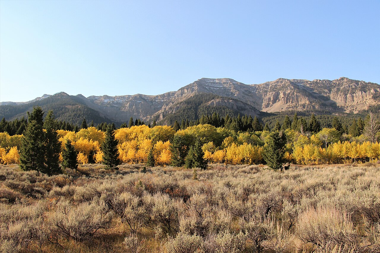
What makes this pass worth respecting is not the grade. By interstate-mountain standards the climb is moderate. No DOT or trucking source documents an unusually steep sustained percentage or a runaway-truck ramp here. The real trouble is weather and wind on an open high plateau. Travel references put the high-country running at roughly 30 mi (48 km) between Lima, MT and Spencer, ID (dangerousroads.org), and that exposed stretch is what closes in winter.

  • Highway summit is 6,870 ft (2,090 m), the highest point on all of I-15 (Wikipedia, Interstate 15 in Montana).
  • Carries I-15 (Veterans Memorial Highway) over the Continental Divide on the Idaho-Montana line, between Spencer/Humphrey, ID and Lima/Monida, MT (Wikipedia).
  • Other cited elevations: Union Pacific railroad crossing 6,820 ft (2,079 m); USGS 'gap' feature about 6,820 to 6,823 ft (TopoZone/USGS).
  • Montana I-15 mileposts reset to 0.000 at the state line; Lima is near milepost 15, Dillon near milepost 62 (Interstate 15 in Montana, Wikipedia).
  • The name is a portmanteau of MONtana and IDAho (Wikipedia).
  • High-country running between Lima, MT and Spencer, ID is about 30 mi (48 km) (dangerousroads.org).
  • The grade is moderate for an interstate mountain crossing; no source documents a runaway-truck ramp here (MDT/ITD/Mountain Directory).
02 Chain controls & closures

winter

03 Notable hazards
Hazard

Blowing and drifting snow with whiteout visibility

The pass sits on an exposed high-elevation plateau. Dry, powdery snow drifts across I-15 and cuts visibility, repeatedly forcing full closures even when snowfall is light. ITD has reported that drifting snow on the roadway forced a closure, and Idaho crews have brought snowblowers to clear the drifts. This is the most common reason the road shuts. Source: NBC Montana/KECI and KPAX closure reports; KRTV Feb 11, 2019.

Hazard

High wind and crosswinds on the open summit

High wind is a recurring trigger for closures here, cited explicitly in the Feb 11, 2019 closure. The same Montana wind events that close I-15 have blown over empty and lightly loaded semis elsewhere on Montana interstates, so a light or empty trailer is most at risk on this exposed crossing. Source: KRTV Feb 11, 2019; KRTV, Powerful winds flip semi trucks across Montana.

Hazard

Ice and snow-packed roadway

Snow and ice covering the road has produced severe driving conditions and closures, such as Oct 9, 2019 from MP 1 to 15.3 on the Montana side. At roughly 6,800 ft the pass freezes and accumulates ice earlier and later in the season than the valleys on either side. Source: NBC Montana/KECI Oct 9, 2019.

Hazard

Rapidly shifting mountain weather year-round

Because of the elevation and exposure, conditions can change fast. Sudden snow, fog, and temperature swings are possible outside mid-summer, and snow and ice closures have been recorded as early as October. Plan for the weather to turn even when it looks clear at the bottom. Source: Wikipedia/dangerousroads.org weather notes; NBC Montana Oct 2019 closure.

04 History

In the 1860s a stage line between Corinne, Utah and the Montana gold fields at Bannack and Virginia City ran over Monida Pass. The Utah & Northern Railway followed the route through Beaver Canyon on the Idaho side by 1880, becoming the first railroad into Montana. That corridor is still in use by Union Pacific today (Wikipedia, Monida Pass).

The town of Monida sits just north of the summit at about 6,788 ft. In the late 1800s and early 1900s it was a railroad stop where passengers transferred to stagecoaches bound for Yellowstone National Park, until the railroad built a branch line over Reas Pass. Monida's post office opened in 1891, and the 2010 census counted six residents. The town's name is the same coined blend that names the pass, MONtana and IDAho, fitting for a spot sitting right on the state line and the Continental Divide (Wikipedia, Monida, Montana).

05 FAQ
Does I-15 over Monida Pass require chains?
No state requires chains at all times here. On the Montana side, MDT only mandates chains where 'chain-up area' signs are posted, but commercial towing units of 26,001 lbs GVW and up must carry chains or an approved traction device from October 1 to April 30. On the Idaho side, I-15 is not a designated chain-control pass. Idaho only chains I-90's Lookout and Fourth of July passes and SH-12's Lolo Pass, so ITD does not post a mandatory chain-up on the Idaho approach. Source: MDT chains.aspx; ITD Idaho Ready / Idaho Code 49-948.
How high is Monida Pass, and is it really the highest point on I-15?
Yes. At 6,870 ft (2,090 m) the highway summit is the highest point on the entire I-15 route, per Wikipedia and the Interstate 15 in Montana article. If you see lower numbers, those are different features: the USGS 'gap' is listed near 6,820 to 6,823 ft and the railroad crossing at 6,820 ft. Source: Interstate 15 in Montana, Wikipedia; TopoZone/USGS.
Why does Monida Pass close so often in winter?
It closes mainly for blowing and drifting snow, high wind, ice, and whiteout visibility on the exposed high plateau, not for snow depth. Light, dry snow drifts across the road and drops visibility fast, so closures happen even in modest snowfall. Source: KRTV Feb 11, 2019; NBC Montana/KECI; KPAX.
When I-15 closes at the pass, where do trucks get detoured?
On the Montana side, southbound traffic has been turned off I-15 at the Barretts interchange south of Dillon, and closures have spanned Dillon (Exit 56) to Idaho Exit 167. ITD has closed the Idaho approach between Exit 167 and the state line. There is no signed truck detour around the pass, so check Montana 511 (mdt.mt.gov) and Idaho 511 (511.idaho.gov) before you commit. Source: KRTV Feb 11, 2019; NBC Montana/KECI; KPAX.
Is Monida Pass a steep grade I should worry about braking on?
Not really. The grade is moderate for an interstate mountain crossing, and no DOT or trucking source documents an unusually steep sustained grade or a runaway-truck ramp at Monida. The real risk is wind and blowing snow on the exposed summit, not a steep descent. Carry chains in winter anyway and watch the crosswinds, especially with an empty or light trailer. Source: driver discussion (montanaowners.com); absence of grade/ramp data in MDT/ITD/Mountain Directory.
When is chain-carry season on the Montana side?
October 1 through April 30. During that window, towing units of 26,001 lbs GVW or greater must carry tire chains or an approved traction device (AutoSock accepted) when traveling where chains may be required. Four-wheel-drive vehicles are exempt from the carry rule. MDT can also require chains at any time year-round in dangerous conditions. Source: MDT Tire and Chain Laws, mdt.mt.gov/travinfo/chains.aspx.
06 Related routes

Monida Pass on the live map

See conditions, incidents, and weather around Monida Pass in real time.

Open Live Map