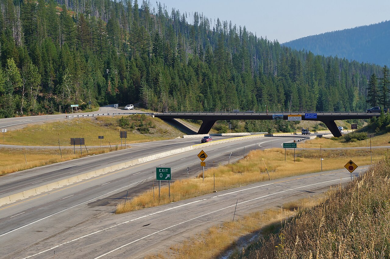
Lookout Pass carries Interstate 90 over the Idaho-Montana state line at 4,710 feet, in the Coeur d'Alene Mountains of the Bitterroot Range. It straddles Shoshone County on the Idaho side and Mineral County on the Montana side. This is the highest point on I-90 between Seattle and Missoula. The summit is signed "Exit 0" once you cross into Montana. The pass also sits on the Pacific/Mountain time-zone line, so your clock changes here too.
For trucks, the westbound Idaho descent is the one that bites. It runs about 6% for roughly 5 miles and drops over 1,300 feet from the summit down to Mullan, threading a set of S-curves on the way down. The state put runaway-truck escape ramps on the westbound lanes because brake fade and jackknifes are a real pattern here. ITD data backs that up. From milepost 64 to the state line, the department logged 101 crashes between October and March over a recent five-year stretch. 47% of them involved a commercial vehicle, even though trucks are only about a third of the traffic.
The other half of the story is snow. The Lookout Pass ski area at the summit averages over 400 inches a year, which tells you how much winter the highway is dealing with. The Montana side is the slide-prone half. Avalanches close I-90 here, sometimes for days. In January 2022, multiple slides between roughly milepost 7 and 10 buried the road and shut a 33-mile stretch from St. Regis, MT up to the Idaho border. Check Idaho 511 and MDT before you commit to the climb in winter.
- Summit elevation 4,710 ft (1,436 m) on the Idaho-Montana line; highest point on I-90 between Seattle and Missoula, signed Exit 0 in Montana (Wikipedia 'Lookout Pass').
- Westbound Idaho descent runs about 6% for roughly 5 miles and drops over 1,300 ft to Mullan, with S-curves and two runaway-truck escape ramps (AARoads; CCD Law citing ITD).
- Idaho's chain law applies only to commercial vehicles over 26,000 lb GVW and is switched on case by case via roadside signs and flashing lights (ITD 'Idaho Ready'; RMS Truckers).
- 101 crashes logged MP 64 to the state line, Oct-Mar, over a recent five-year period; 47% involved commercial vehicles versus about one-third of traffic (RMS Truckers citing ITD).
- The summit ski area averages over 400 inches of snow a year (Wikipedia 'Lookout Pass Ski and Recreation Area').
- January 2022 avalanches near MP 7-10 on the Montana side closed a roughly 33-mile stretch from St. Regis, MT to the Idaho border (Flathead Beacon; NBC Montana).
- The pass also marks the Pacific/Mountain time-zone boundary (Wikipedia 'Lookout Pass').