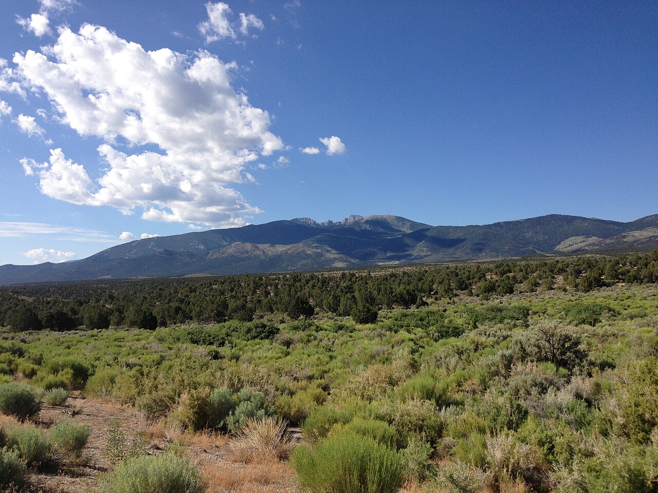
Sacramento Pass carries US 6 and US 50 over the Snake Range in eastern Nevada, in White Pine County. The summit sits at 7,154 ft (2,181 m). Here the two highways run together, climbing from the basin near Majors Place, the junction of US 6, US 50, and US 93, up toward the high country below Wheeler Peak. This is the main east-west crossing of the eastern Great Basin. It links Ely, the White Pine County seat about 40 miles west, with the Utah state line and the road on toward Delta.
For truckers, the draw and the danger are the same thing: distance. US 50 across Nevada is the road Life magazine called the Loneliest Road in America back in July 1986, and the name stuck. Services are far apart. The crossing is a real one, over 7,100 ft, and winter weather up here is harsh. If you are running eastbound out of Ely, the steeper climb hits you first at Connors Pass, then you cross Sacramento Pass before Utah.
The pass is also the highway gateway to Great Basin National Park. NV-487 and NV-488 leave US 6-50 just before the Utah line and run south toward Baker and the park. The Sacramento Pass Recreation Area, a BLM campground, sits along the highway at about 6,851 ft, below the road summit itself. Plan fuel and rest with the long gaps in mind, and check conditions before you climb in winter.
- Summit elevation is 7,154 ft / 2,181 m on US 6-50 over the Snake Range (Wikipedia US-50 in Nevada; AARoads; SoCalRegion)
- Located in White Pine County, eastern Nevada, about 40 miles east of Ely or 15 miles west of the Utah line (BLM)
- US 6 and US 50 run together here, climbing east of Majors Place near Wheeler Peak at 13,063 ft (AARoads)
- The BLM Sacramento Pass Recreation Area campground sits at about 6,851 ft, below the road summit (Nevada Horse Trails)
- Eastbound drivers from Ely cross Connors Pass, 7,729 ft and the highest point on US-50 in Nevada, before reaching Sacramento Pass (Wikipedia US-50 in Nevada)
- Nevada chains run on R1, R2, and R3 levels posted by condition, not by calendar (NDOT Traction and Chains Requirement Descriptions)
- Vehicles over 10,000 lb must chain when posted, or run Mechanical Traction Devices on the drive axles (NDOT)