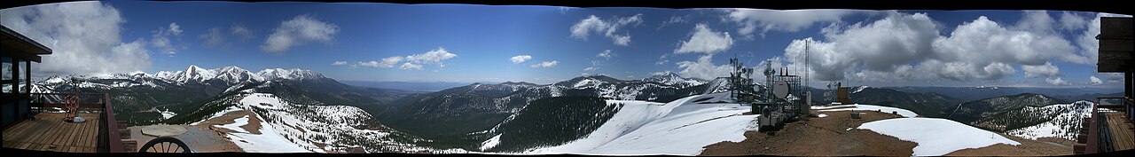
Monarch Pass carries US-50 over the Continental Divide at the south end of the Sawatch Range in central Colorado, on the Gunnison/Chaffee county line. The summit sits at 11,312 feet (USGS GNIS, via Wikipedia). The pass is about 20 to 25 miles west of Salida. It ties the upper Gunnison River basin on the west to the South Arkansas River drainage on the east. Monarch Mountain ski area straddles the highway right at the divide crossing, so in winter ski traffic climbs the same grade as the trucks.
Both descents are long and steady, not gentle. The east side toward Salida runs about 10 miles at 6 percent. The west side toward Gunnison runs about 9 miles at 6 percent, with some reports of pitches up to 7 percent (Wikipedia). The road is curve-heavy on the way down. Wikipedia lists ten curves advised at 35 mph and one at 30. The truck-specific safe descent speeds tell the story. Crash Forensics figures put a 50,000 lb truck at about 45 mph and an 80,000 lb truck at just 15 mph (cited in Wikipedia). On the longer east grade that means a real risk of cooking your brakes if you let the speed creep.
CDOT keeps the pass open year-round and it is generally open, but it closes on short notice for snow removal and avalanche control during storms. The top is violently exposed. The summit AWOS station once recorded a 148 mph gust, the highest official wind gust ever logged in Colorado (NWS Pueblo). A CDOT station 700 feet lower read 32 mph at the same moment, which tells you how local and how brutal the wind at the top can get.
- Summit 11,312 ft on US-50 over the Continental Divide, on the Gunnison/Chaffee county line (USGS GNIS, via Wikipedia)
- East descent toward Salida runs about 10 miles at 6 percent; west descent toward Gunnison about 9 miles at 6 percent, with reports up to 7 percent (Wikipedia)
- Ten curves advised at 35 mph and one at 30; safe descent speed about 45 mph for a 50,000 lb truck, 15 mph for an 80,000 lb truck (Wikipedia, citing Crash Forensics)
- Commercial chain-up corridor of multiple lit stations on US-50 between mile points 189 and 211 across Chaffee, Gunnison and Saguache counties (CDOT; TheTrucker.com)
- Commercial vehicles must carry chains Sept 1 to May 31, even when no law is active (Colorado State Patrol; CDLLife)
- Roughly 240+ inches of snow a year; the ski area at the summit reports about 400 inches (Wikipedia, NOAA data; Wikipedia 'Monarch Mountain')
- Summit AWOS once clocked a 148 mph gust, Colorado's highest official wind gust on record (NWS Pueblo)