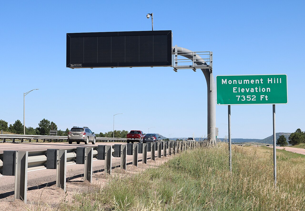
Monument Hill is the high point on I-25 between Denver and Colorado Springs, with a summit elevation of 7,352 ft. It sits on the crest of the Palmer Divide, a caprock ridge that splits the Arkansas River basin to the south from the South Platte basin to the north. Drivers and locals also call it the Black Forest Divide Pass or Monument Hill Divide. The 18-mile stretch of I-25 between Castle Rock and Monument carries the nickname "The Gap."
This is not a single steep pitch. Heading north from the summit, I-25 sheds over 1,000 ft of elevation across those 18 miles, so it reads as a long moderate grade rather than a wall. Castle Rock sits at 6,202 ft, roughly 1,150 ft below the top. No official percent-grade figure for the steepest section was found, so go by the elevation change and plan for a sustained climb either way you take it.
Truckers care about Monument Hill because it is the highest sustained grade on the Denver to Colorado Springs corridor and it sits in an upslope snow zone that can dump far more snow than the cities at either end. It is a recurring site of multi-truck slideouts and winter closures. During the I-25 South Gap rebuild, CDOT added truck climbing lanes near Monument Hill and the Greenland exit, plus a southbound chain-up station in Larkspur so drivers can hook up before the climb.
- Summit elevation is 7,352 ft, the highest point on I-25 between Denver and Colorado Springs (Wikipedia, citing CDOT segment list; AARoads)
- I-25 drops over 1,000 ft from the summit across the 18-mile "Gap" between Monument and Castle Rock (AARoads)
- Castle Rock sits at 6,202 ft, about 1,150 ft below the summit (AARoads)
- Colorado's Must Carry Law requires commercial vehicles over 16,000 lbs to carry chains Sept. 1 to May 31 (CDOT, Oct. 2025)
- The state has 130 designated chain stations across more than 1,400 centerline miles (CDOT, Oct. 2025)
- In the March 13-15, 2024 storm, NWS Boulder logged 20.0 to 25.7 in near Castle Rock and 25 to 28 in at Sedalia (NWS Boulder)
- The I-25 South Gap rebuild ran Sept. 2018 to Nov. 2022 and cost $419 million (CDOT South Gap project page)