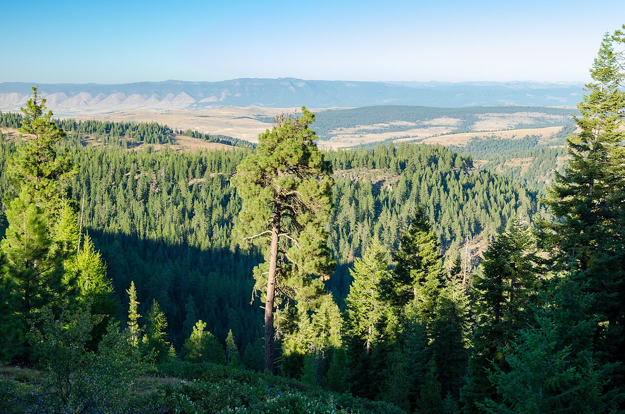
Ladd Canyon Hill is a steep stretch of I-84 in eastern Oregon, in Union County between La Grande and North Powder. The eastbound climb runs about two miles at a roughly 6 percent grade. ODOT measured it precisely: 6.16 percent at the bottom, an average of 6.03 percent up the hill, easing to near-flat by the top. Loaded trucks heading east crawl up it at 10 to 15 mph, and when one truck passes another, both eastbound lanes get blocked and traffic backs up behind them.
The trouble starts at the bottom. The eastbound climb begins on a box-girder bridge set in a banked curve, a 1,332-foot-radius turn with 9.4 percent superelevation and a 6.16 percent grade. At slow truck speeds the banking pulls a vehicle toward the inside of the turn. On ice, trucks slide across the shoulder into the center concrete barrier. ODOT calls Ladd Canyon a stretch with notoriety among the freight industry for being a treacherous section of road, and it says closures there are often the result of commercial-vehicle spin-outs and wrecks.
This is a working freight corridor. I-84 here links the Columbia Plateau and the Grande Ronde Valley to the Baker Valley, Ontario, and Idaho. Ladd Canyon is an officially designated I-84 chain-up zone, and ODOT has spent years and money trying to keep the hill open in winter: electric heating cable embedded in the bridge deck and right lane, snow fencing near the summit, and a third truck-climbing lane added in 2018 to 2019. A note on elevation: a clean primary-source figure for the highway summit was not found, so this guide does not state one.
- Climb is about two miles long at a roughly 6 percent grade; ODOT measured an average of 6.03 percent and 6.16 percent at the bottom bridge (ODOT/FHWA SPR 304-461; ODOT Freight PIP)
- The eastbound climb starts on box-girder Bridge No. 09686 at MP 270.87, set in a 1,332-foot-radius curve with 9.4 percent superelevation and a 6.16 percent grade; design speed 55 mph (ODOT/FHWA SPR 304-461)
- Steep-grade and chain-up work is centered on roughly MP 270 to 273; Exit 270 is Ladd Canyon Road / Ladd Creek (ODOT Freight PIP; SPR 304-461)
- Electric heating cable runs 7,700 ft up the grade beyond the bridge plus 300 ft before it, over 8,000 ft total (ODOT Freight PIP; SPR 304-461)
- Loaded eastbound trucks crawl at 10 to 15 mph on the climb (ODOT Freight PIP)
- ODOT publicly cites an $880 fine per incident for commercial chain-law violations (ODOT; Elkhorn Media Group, Dec 2025)
- The 2018 to 2019 Freight and Culvert Improvement Project cost about $20.4 million and added a third eastbound truck-climbing lane (MP 270.39 to 272.81) (ODOT Freight PIP)