← All passes
Mountain pass No. 30 No live data

In-Ko-Pah Gorge

I-8 drops 3,000 feet in 11 miles at the Mountain Springs/In-Ko-Pah grade, the steep step between the East San Diego County mountains and the Imperial Valley floor. It is the main truck corridor between San Diego and Imperial County toward Yuma. The descent is long and sustained,

3,000Elevation (ft)
914Metres
I-8Route
CAState
A view north toward Interstate 8 as it descends through the In-Ko-Pah area, seen from the top of the Desert View Tower near Jacumba Hot Springs, California.
A view north toward Interstate 8 as it descends through the In-Ko-Pah area, seen from the top of the Desert View Tower near Jacumba Hot Springs, California.Seauton / Wikimedia Commons · CC BY-SA
00 Live conditions
No live data
No live condition feed for this pass right now. Check the state DOT or 511 before you climb.
01 Overview

I-8 drops 3,000 feet in 11 miles at the Mountain Springs/In-Ko-Pah grade, the steep step between the East San Diego County mountains and the Imperial Valley floor. It is the main truck corridor between San Diego and Imperial County toward Yuma. The descent is long and sustained, the kind where a loaded rig has to think about brake heat from the top, not halfway down.

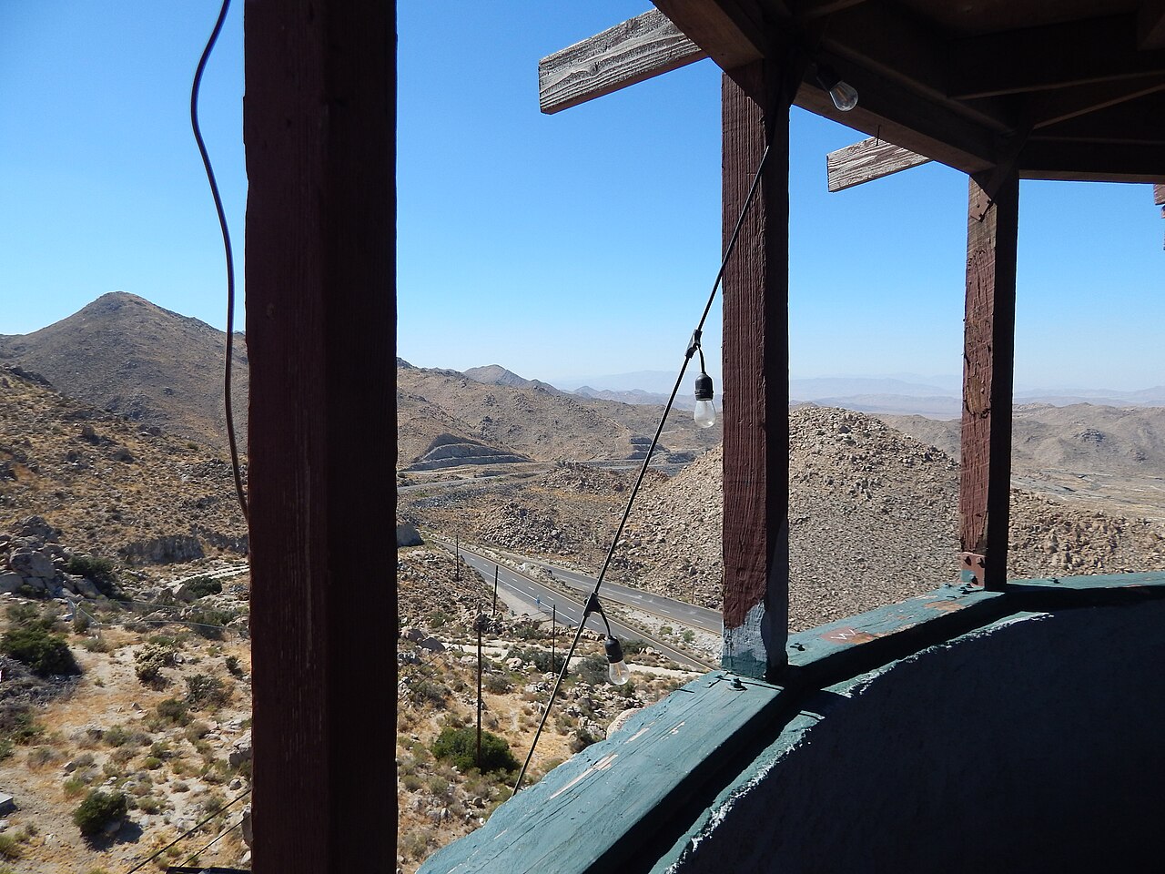
One thing surprises first-time drivers here: the freeway splits in two. Westbound traffic runs through Devils Canyon and eastbound runs through In-Ko-Pah Gorge, with a median that exceeds 1.5 miles wide in places (Wikipedia, "Interstate 8"). The grade straddles the San Diego and Imperial county line and passes near Jacumba Hot Springs and Ocotillo. The gorge head sits at 2,240 feet and the mouth at 846 feet (Wikipedia, "In-Ko-Pah Gorge").

There is no fixed seasonal closure on this stretch. What closes it is weather and rock: high canyon winds, winter snow and ice in the higher East County section, and the occasional rockslide. Truckers have feared this grade for a long time, and the history below explains why. Manage the downgrade in a low gear with engine braking, and watch the wind reports when a front moves through.

  • I-8 descends 3,000 ft over 11 miles at the Mountain Springs/In-Ko-Pah grade (Wikipedia, "Interstate 8")
  • The freeway splits into two canyons here: westbound through Devils Canyon, eastbound through In-Ko-Pah Gorge, median over 1.5 miles wide in spots (Wikipedia, "Interstate 8")
  • Gorge head sits at 2,240 ft, the mouth at 846 ft (Wikipedia, "In-Ko-Pah Gorge")
  • The grade straddles the San Diego and Imperial county line near Jacumba Hot Springs and Ocotillo (Wikipedia)
  • In 1966 CHP estimated canyon winds up to 100 mph along this part of I-8 (Wikipedia, "Interstate 8")
  • Original Mountain Springs Grade was surveyed at a 22% grade in 1908 before later realignments (gribblenation)
  • Main truck corridor between San Diego and Imperial County toward Yuma (gribblenation)
02 Chain controls & closures

California chain control here is event-driven, not a fixed calendar. The season runs roughly late fall through early spring, and Caltrans posts control only when a storm warrants it. Levels follow the statewide scale: R-1 means chains on all vehicles except passenger cars and light trucks under 6,000 lb GVW with snow tires on at least two drive wheels; R-2 means chains except 4WD/AWD with snow tread on all four; R-3 means chains on everything, no exceptions, and highways usually close before R-3 (Caltrans, "Chain Controls"). Snow and ice do hit the higher East County section, from the SR-79 Guatay area up to the In-Ko-Pah Park exit east of Jacumba, where Caltrans and CHP have stopped traffic and escorted cars and trucks in convoys behind snowplows (CBS8). There are no fixed In-Ko-Pah season dates in any Caltrans source, and named chain-up pullouts here are not officially documented, so check Caltrans QuickMap for current control points before you climb.

03 Notable hazards
Hazard

High canyon winds

Winds funnel through the canyons and make driving hard, and have closed the freeway. In 1966 CHP estimated gusts up to 100 mph along this part of I-8 (Wikipedia, "Interstate 8"). A high-profile rig feels this fast, so check the wind report before you commit to the grade.

Hazard

Long sustained downgrade and brake heat

Dropping 3,000 ft over 11 miles is a prolonged descent where heavy trucks risk brake fade or fire (descent figure from Wikipedia, "Interstate 8"). Pick a low gear at the top and let engine braking do the work instead of riding the service brakes. This guidance is general trucking practice, not an I-8-specific rule.

Hazard

Rockslides and falling boulders

Steep rock walls above the eastbound In-Ko-Pah Gorge alignment can drop boulders onto the roadway and close lanes. The August 20, 2023 slide during Hilary put school-bus-size boulders on the freeway (East County Magazine; Fox5 San Diego).

Hazard

Snow and ice in the higher East County section

The upper I-8 through East San Diego County, from Guatay near SR-79 up to the In-Ko-Pah Park exit by Jacumba, ices over and accumulates snow in winter storms. Big rigs have gotten stuck and needed CHP assistance, and traffic has moved in snowplow-escort convoys (CBS8; Fox5 San Diego).

04 History

The corridor started as a Native American trail from the Colorado River region, running by Carriso Creek toward what became Jacumba Hot Springs, and a wagon road crossed the In-Ko-Pah Gorge and Mountain Springs area by the 1850s (socalregion.com; gribblenation). San Diego County surveyed the Mountain Springs Grade in 1908 and found a 22% grade. Oxen teams once pulled wagons up it. Construction of an improved grade began in 1912, and the state took over maintenance in 1914 (gribblenation). Even after paving, the tight curves stayed dangerous, and some truckers rerouted Imperial Valley produce to avoid the climb.

A major realignment began on October 29, 1938, designed to eliminate sixteen curves and nearly a thousand degrees of curvature. A 2.55-mile first unit was completed and publicized in January 1940 (gribblenation). Rock still falls here. On August 20, 2023, during Tropical Storm Hilary, a rockslide dropped boulders described as about as big as a school bus onto I-8 at In-Ko-Pah, closing the freeway with eastbound lanes hardest hit. Caltrans cleared the boulders and scaled the unstable rock; westbound returned to normal and one eastbound lane reopened around 1 a.m. the following Tuesday (East County Magazine; Fox5 San Diego).

05 FAQ
How steep and how long is the I-8 grade at In-Ko-Pah?
I-8 descends 3,000 ft over 11 miles at the Mountain Springs/In-Ko-Pah grade (Wikipedia, "Interstate 8"). That works out to roughly a 5% average across the full descent. The exact posted grade percentage is not verified from a Caltrans source, so go by the signage you see on the road rather than a fixed number.
Why are eastbound and westbound I-8 split apart here?
At this grade the freeway runs through two separate canyons. Westbound uses Devils Canyon and eastbound uses In-Ko-Pah Gorge, and the median between them tops 1.5 miles wide in spots (Wikipedia). It surprises drivers the first time, but it is normal here.
Does I-8 close at In-Ko-Pah, and why?
Yes, on an event basis. High canyon winds have closed it, with CHP measuring about 100 mph back in 1966. Winter snow and ice shut the higher East County section at times, and rockslides close lanes, as the August 20, 2023 boulder slide during Hilary did. There is no fixed seasonal closure (Wikipedia; East County Magazine; Fox5).
Do I need chains on I-8 through here?
Only when Caltrans posts chain control during a winter storm. The levels are R-1, R-2, and R-3 as defined statewide (Caltrans, "Chain Controls"). Snow, ice, and snowplow-escort convoys have happened between SR-79 at Guatay and the In-Ko-Pah Park exit near Jacumba (CBS8). Named chain-up pullouts and mile markers here are not officially documented in the sources I found, so verify on Caltrans QuickMap.
Is there a runaway truck ramp on the In-Ko-Pah grade?
I can't confirm one. No Caltrans or encyclopedic source documents a runaway truck ramp at In-Ko-Pah or Mountain Springs, so don't count on a ramp being there. Manage the long downgrade with a low gear and engine braking to keep your brakes from overheating.
Has this grade always been bad for trucks?
Pretty much. The original Mountain Springs Grade was surveyed at 22% in 1908, oxen teams once pulled wagons up it, and even after paving the tight curves were dangerous enough that some truckers rerouted Imperial Valley produce to avoid it. Major realignments starting October 29, 1938 cut out sixteen curves (gribblenation; socalregion).
06 Related routes

In-Ko-Pah Gorge on the live map

See conditions, incidents, and weather around In-Ko-Pah Gorge in real time.

Open Live Map