Interstate 80 is the second-longest interstate in the United States and the main east-west route across the northern tier of the country. Stretching 2,899 miles from the San Francisco Bay Area to Teaneck, New Jersey, it shadows much of the original 1913 Lincoln Highway and remains one of the busiest freight routes in North America. I-80 is a designated Tier I east-west freight corridor (Mid-America Freight Coalition), one of the few highways that lets freight cross from one coast to the other on a single route, so a large amount of long-haul cross-country freight uses at least part of the corridor.
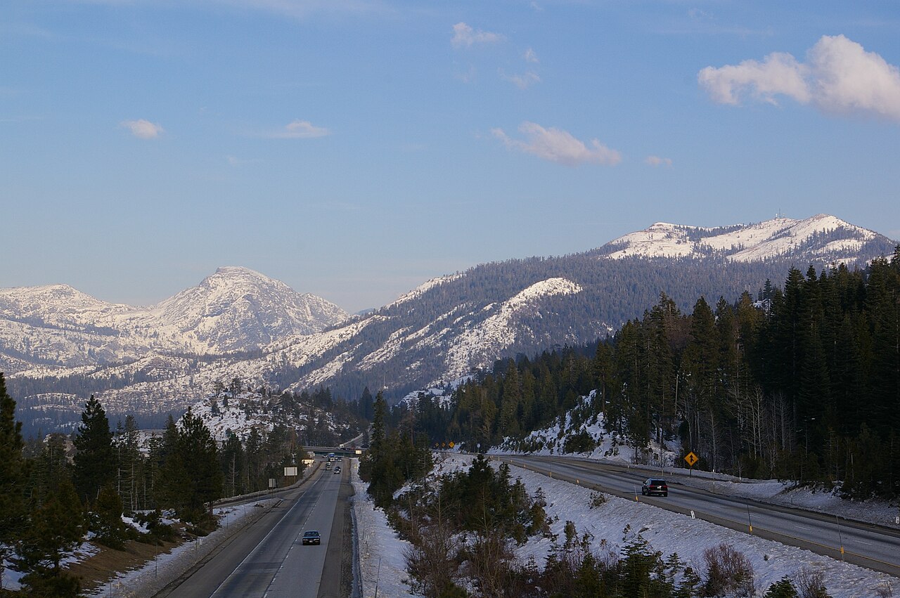
The route crosses three of the most consequential geographic barriers on the continent: the Sierra Nevada at Donner Pass (7,239 ft), the Wasatch Range east of Salt Lake City, and the Continental Divide at Sherman Hill, Wyoming (8,640 ft), the highest point on the entire interstate system. From there it rolls eastward through the Great Plains, hugs the Platte River across Nebraska, threads the corn belt of Iowa, brushes the south side of Chicago, and climbs the Allegheny Plateau before dropping into the New York metro area. Weather closures, chain controls and high-profile vehicle restrictions are routine across the western half between November and April.
For commercial drivers, I-80 is also a service-rich corridor: the original transcontinental truck stops at places like Walcott, Iowa and Sidney, Nebraska grew up alongside it, and the route is densely covered by fuel networks, weigh stations, and mandatory chain-up areas. Connections at Salt Lake City (I-15), Omaha (I-29), Des Moines (I-35), Chicago (I-94/I-294) and the Northeast (I-95/I-78/I-280) make it a key connector across the national freight network.
- One of the primary transcontinental freight corridors, carrying heavy long-haul truck volumes
- Crosses the Sierra Nevada at Donner Pass (7,239 ft). The most chain-controlled pass in the lower 48
- Reaches its highest point at Sherman Summit, Wyoming (8,640 ft), the highest elevation on any US interstate
- Designated wind-closure corridor between Laramie and Walcott Junction, WY (Elk Mountain segment closes 30+ days/year for high-profile vehicles)
- Concurrent with I-90 across most of central Indiana / northern Ohio (Indiana / Ohio Turnpike)
- Tolled across Pennsylvania, Ohio, Indiana, and the I-80/90 concurrency segment
- Crosses the Mississippi River at Le Claire, Iowa and the Missouri River at Council Bluffs