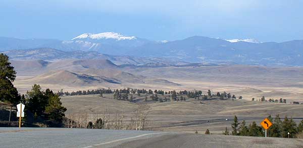
Trout Creek Pass sits at 9,346 ft on the Park-Chaffee county line, at the southern end of the Mosquito Range in San Isabel National Forest. US-24 and US-285 run together over the top, co-signed for the climb. The pass is the divide between two worlds: the open South Park basin and the South Platte headwaters to the east, and the Arkansas River valley around Buena Vista and Johnson Village to the west. The two highways split and merge near Johnson Village at the south end and around the Antero Junction and Hartsel area at the north end.
For a loaded truck, the work is the descent. The south and west side runs a sustained grade of roughly 5 percent dropping toward Johnson Village and Buena Vista, while the north and east approach off South Park is gentle. The grade itself is moderate, but US-285 is a corridor you cannot easily avoid, and it is one of only seven routes on Colorado's commercial Must Carry chain list. When the road closes, the official detour is long: US-24 to I-25 at Colorado Springs and up to I-70.
Most of the documented severe weather trouble on this stretch of US-285 happens on the South Park side, between Fairplay, Grant and Kenosha Pass, not on the Trout Creek grade proper. South Park is one of the coldest and windiest high basins in Colorado, and wind over snow has iced and closed the road there more than once. The Trout Creek grade itself is usually open all year and closes only in severe winter storms.
- Summit elevation is 9,346 ft, 2,849 m (Wikipedia, topographic figure; the highway sign differs by about 140 ft)
- South and west side grade is roughly 5 percent toward Buena Vista; the north and east approach off South Park is gentle (Wikipedia; dangerousroads.org)
- US-24 and US-285 run concurrently over the pass, splitting near Johnson Village and merging near the Antero Junction and Hartsel area (Wikipedia)
- US-285 is one of seven corridors on Colorado's commercial Must Carry chain list (CDOT)
- Must Carry season runs September 1 to May 31; statewide there are 130 chain stations and 1,400-plus centerline miles covered (CDOT, Oct 2025)
- The pass marks the divide between the South Park basin and South Platte headwaters on the east and the Arkansas River valley on the west, on the Park-Chaffee county line (Wikipedia)
- Antero Reservoir, on US-285 between Fairplay and Buena Vista, dropped to minus 50 F on Dec 30, 2020 (CBS Colorado, citing NWS)