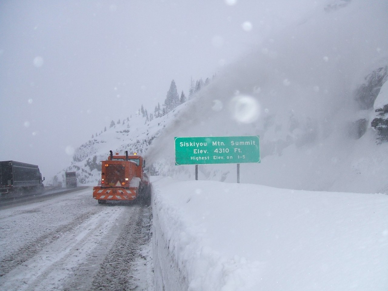
Siskiyou Summit is the high point of Interstate 5. At 4,310 feet, it is the tallest spot the freeway hits over its roughly 1,381 miles from the Mexican border to the Canadian one (Oregon DOT, via Wikipedia). The summit sits in the Siskiyou Mountains about 12 miles south of Ashland, Oregon. It is around 4 miles north of the California line and about 25 miles north of Yreka. More than 13,000 vehicles a day run this stretch, and ODOT says roughly half the vehicles in crashes here were commercial trucks pulling trailers.
The northbound side is what bites. From the top, a loaded rig drops about 2,300 feet in roughly 6 miles on a sustained 6 percent grade through sharp curves. It is often called the steepest grade anywhere on I-5 (dangerousroads.org). Brakes that come down hot turn into runaways. That is why ODOT built two escape ramps on the descent, at Milepost 6.3 and Milepost 9.5. Check your brakes before you start down. Pick a speed you can hold, and stay in low gear.
Weather makes the grade worse. Fog, snow, and black ice are common from October through April. The north-side descent is known for fog dropping visibility to almost nothing, especially at night. Truck inspection and chain-check sites sit at Milepost 1 northbound and Milepost 11 southbound, with chain-up areas set ahead of them so you have shoulder room to get your chains on before the snow line. Show up at the inspection site without chains fully on and you get turned around.
- Highest point on Interstate 5 at 4,310 ft (1,314 m), over the freeway's full ~1,381-mile run (Oregon DOT, via Wikipedia)
- Northbound descent drops about 2,300 ft in roughly 6 miles on a sustained 6 percent grade (ODOT Respect the Pass)
- Often called the steepest grade on I-5 (dangerousroads.org)
- More than 13,000 vehicles a day use this stretch; about half the vehicles in crashes here were commercial trucks with trailers (ODOT Respect the Pass)
- Two northbound runaway-truck escape ramps, at Milepost 6.3 and Milepost 9.5 (ODOT Respect the Pass)
- Inspection and chain-check sites at Milepost 1 northbound and Milepost 11 southbound, with chain-up areas set ahead of them (ODOT Respect the Pass)
- Fog, snow, and black ice common October through April, with fog cutting visibility to near zero on the north-side descent (ODOT Respect the Pass; dangerousroads.org)