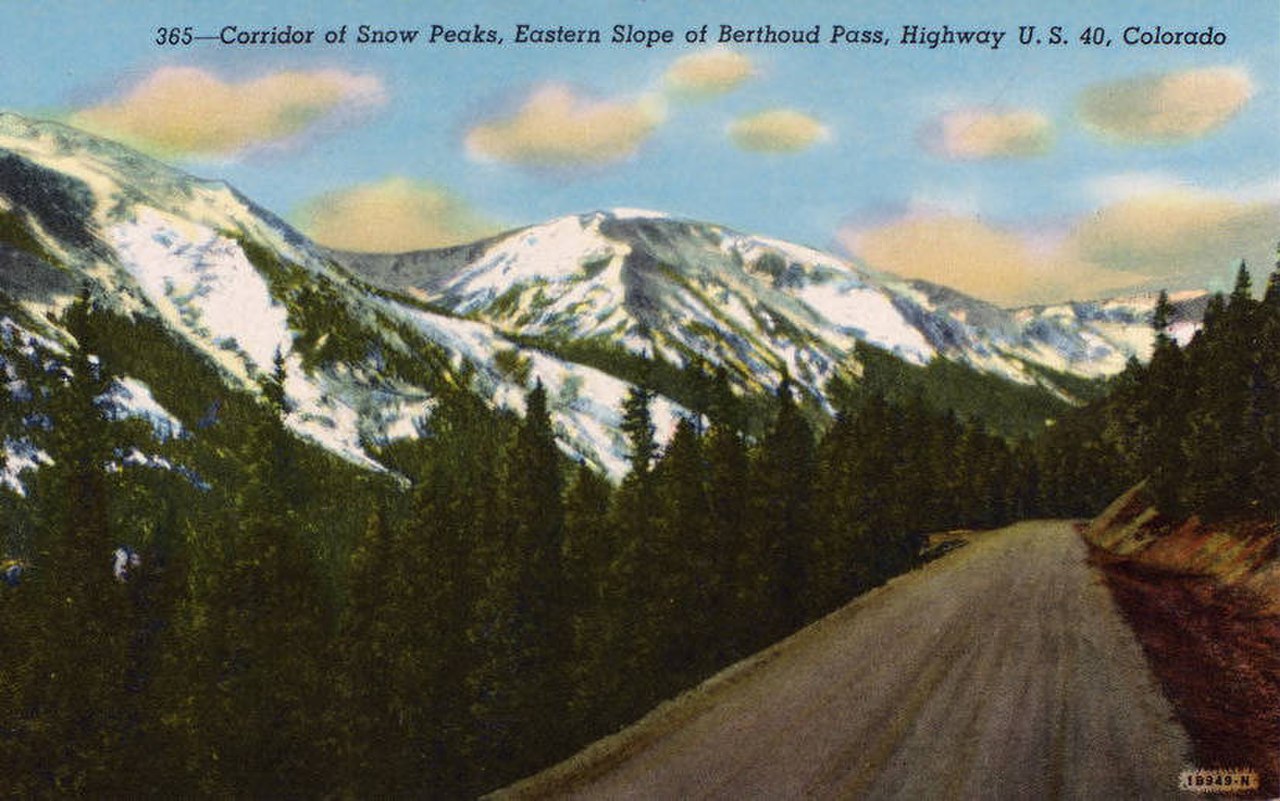
US-40 crosses Berthoud Pass at 11,307 feet (3,446 m), where the highway tops the Continental Divide on the Clear Creek and Grand County line in Colorado's Front Range. The road links Empire on the south side, near the I-70 junction in Clear Creek Canyon, with Winter Park and the Fraser Valley to the north. The full Empire-to-Granby run over the top is about 46.7 miles (75 km). CDOT keeps this road open and plowed year-round. There is no seasonal closure. But for a heavy truck it is one of the harder pass crossings in the state.
The grade is the first reason. US-40 climbs about 6.3 percent on both the north and south approaches. That means a long pull on the way up and a long brake-burner on the way down. The south side, out of Empire, is the twisty one. A series of switchbacks and hairpin turns climbs to the summit, and that string of tight bends is what earned the pass its white-knuckle name. Big motorhomes and trucks routinely cross the centerline on the bends, so watch the oncoming lane.
The other reason is snow. At least 55 avalanche paths have been mapped on Berthoud Pass. Several cross US-40, some at more than one point, which puts it among the most avalanche-exposed stretches of state highway in Colorado. CDOT plows the road through winter, but heavy snow, high winds, and avalanche danger routinely force temporary closures for control work or after a slide. Plan the crossing around the weather, and check conditions before you commit to the climb.
- Summit 11,307 ft (3,446 m) on US-40, topping the Continental Divide on the Clear Creek / Grand County line (Wikipedia)
- Sustained grades of about 6.3 percent on both the north and south approaches (Wikipedia; Coloradotopia)
- Empire to Granby over the pass is roughly 46.7 miles / 75 km (Uncover Colorado; Dangerousroads.org)
- At least 55 mapped avalanche paths on the pass, several crossing US-40 (Wikipedia, citing CAIC/CDOT)
- Kept open and plowed year-round, with temporary closures for avalanche control and storms (Dangerousroads.org; CDOT)
- South (Empire) approach climbs through a long series of switchbacks and hairpin turns to the summit (Wikipedia; Dangerousroads.org)
- Site of a former ski area, now a fee-free backcountry-ski trailhead where the Continental Divide Trail crosses US-40 (Colorado Ski History; Wikipedia)