← All passes
Mountain pass No. 22 No live data

Jellico Mountain

Jellico Mountain is where I-75 crosses the Cumberland Mountains in Campbell County, Tennessee, just south of the Kentucky line. The interstate connects Jellico, TN (Exit 160, US 25W) with Williamsburg, KY to the north, and it ties the Knoxville area and the Caryville/LaFollette c

2,200Elevation (ft)
671Metres
I-75Route
TN/KYState
Interstate 75 descending the northbound downslopes of Jellico Mountain in Tennessee, a few miles south of the Kentucky line.
Interstate 75 descending the northbound downslopes of Jellico Mountain in Tennessee, a few miles south of the Kentucky line.TheWxResearcher / Wikimedia Commons · Public domain
00 Live conditions
No live data
No live condition feed for this pass right now. Check the state DOT or 511 before you climb.
01 Overview

Jellico Mountain is where I-75 crosses the Cumberland Mountains in Campbell County, Tennessee, just south of the Kentucky line. The interstate connects Jellico, TN (Exit 160, US 25W) with Williamsburg, KY to the north, and it ties the Knoxville area and the Caryville/LaFollette corridor into southeastern Kentucky toward Corbin. The ridge is geologically part of Pine Mountain, but locally everyone just calls the I-75 crossing Jellico Mountain.

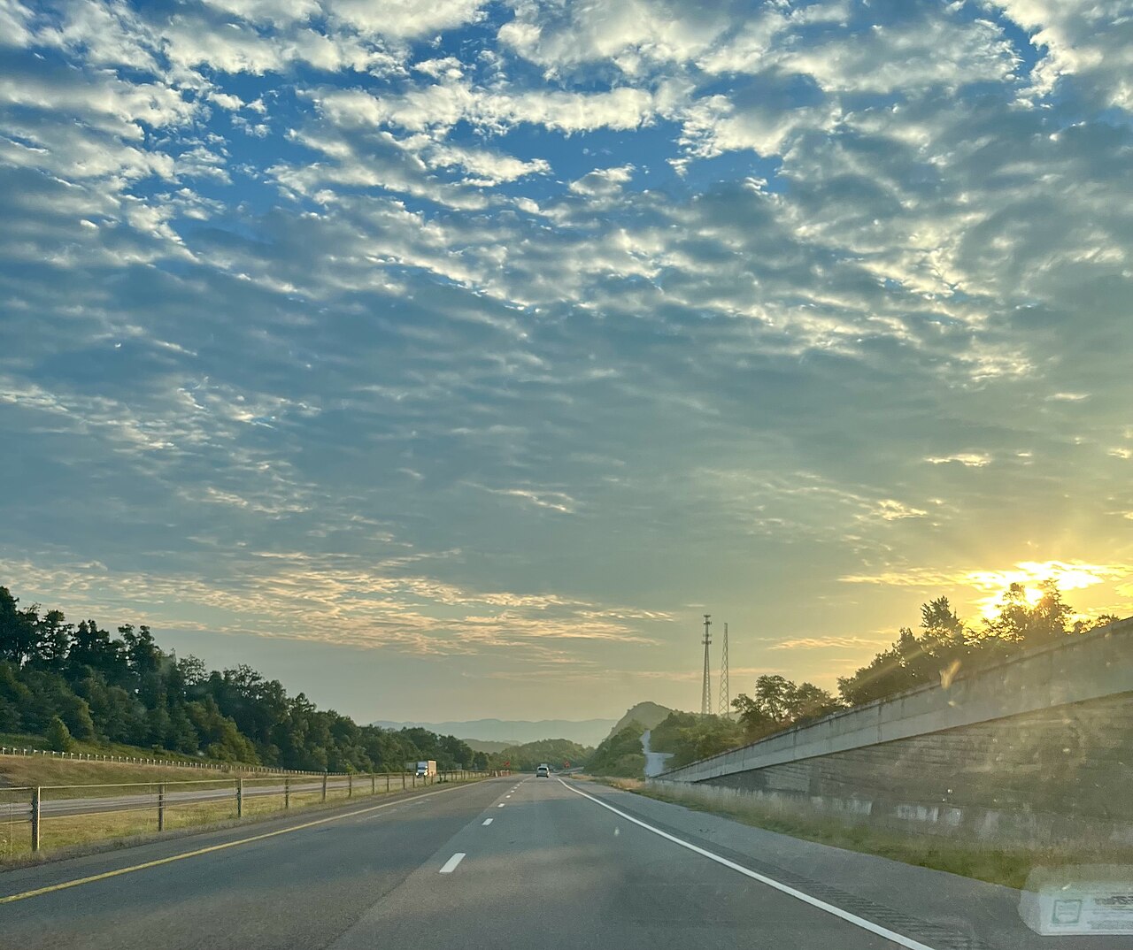
This is the highest point on I-75 anywhere along its run from Florida to Michigan, sitting at more than 2,000 feet, and the interstate stays up in the peak area for roughly 8 miles (Wikipedia, Interstate 75 in Tennessee). The grade is documented at 6% (The Buzz, 2021 University of Memphis study, TDOT-advised). Northbound is the long climb, with a truck climbing lane added for the final pull that ends at the summit. Southbound is the long descent, and that is the direction where brake heat and runaway trucks are the worry.

What makes the mountain hard is the weather stacked on top of the grade. Dense fog rolls in often, the slopes are rockslide-prone, and winter brings snow, ice, and high winds. TDOT and the researchers who studied the corridor describe it as one of the most hazardous stretches of I-75 in Tennessee, known for a high crash rate tied to weather and grade. If you run this road, slow down through the fog zone, watch your brakes on the descent, and check conditions before you go.

  • Highest point on all of I-75, Florida to Michigan, at more than 2,000 ft, with the interstate up in the peak area for about 8 miles (Wikipedia, Interstate 75 in Tennessee)
  • Grade is documented at 6%; secondary trucking sources call it roughly a 5-mile descent (The Buzz 2021 study; 4RoadService)
  • Northbound climb adds a truck climbing lane that ends at the summit; southbound is the long descent where brake heat is the concern
  • Tennessee has no mandatory chain law: under TN Code 55-9-106, tire chains are permissive, not required (Tennessee Code 55-9-106 via FindLaw)
  • Worst crashes cluster around mile markers 155 to 159, where fog and ice combine with the grade
  • The low-visibility fog zone runs 4.4 miles between Exit 156 (Rarity Mountain Rd) and Exit 160 (US 25W), posted 65 mph (The Buzz 2021 study)
  • NWS Morristown (MRX) issues the fog, wind, and winter advisories for Campbell County (NWS Morristown CWA)
02 Chain controls & closures

There is no chain-control season on Jellico Mountain, because Tennessee does not run a western-style chain program at all. Under Tennessee Code 55-9-106, tire chains are permissive: you may use them when snow, ice, or similar conditions could cause your vehicle to skid, but nobody requires them and nobody turns you around at a chain-up station. There are no chain-control levels, no posted chain season, and no verified named chain-up or brake-check areas on the mountain. Closures here are incident-driven instead. When a crash, snow and ice, dense fog, or a rockslide hits, TDOT and the Tennessee Highway Patrol shut lanes or the whole interstate as needed, and they reopen it once the road is clear. There is no published wind or temperature number that automatically closes the mountain.

03 Notable hazards
Hazard

Dense fog

This is the recurring hazard that defines the mountain. The low-visibility zone runs 4.4 miles between Exit 156 (Rarity Mountain Rd) and Exit 160 (US 25W), posted at 65 mph. Ridge topography and local industry produce fog that drops visibility hard, and TDOT has put up dynamic message signs and changeable speed-limit signs through the segment (The Buzz 2021 study). Back off your speed and leave room when the fog sets in.

Hazard

Snow and ice pileups

Winter brings multi-vehicle crashes on the grade. On March 12, 2022, several tractor-trailers crashed between mile markers 157 and 159 after more than 5 inches of overnight snow, and one southbound lane stayed closed (WYMT, Mar. 12, 2022). The grade plus a slick surface gives loaded trucks nowhere to stop.

Hazard

Fog and snow chain-reaction crashes

Low visibility and heavy traffic feed big chain-reaction wrecks. On February 18, 2021, TDOT reported a crash involving more than 20 vehicles; southbound I-75 near mile marker 155 was shut for hours, three people were hurt, and traffic backed up into Kentucky before lanes reopened that evening. THP traced the first crash to a vehicle slowing for heavy traffic and fog (WATE and WBIR, Feb. 2021).

Hazard

Rockslides and slope failures

The cut slopes are prone to rockslides, a mix of heavy rainfall and the original roadway slope design. TDOT mitigates with rockfall drapes, benches, wire mesh, catchment areas, fencing, and Falling Rock signage (The Buzz 2021 study). The 2016 rockslide near mile marker 141.5 closed I-75 between Exit 141 and Exit 160 for weeks (WKYT, 2016).

Hazard

High winds

Strong wind is listed as a corridor weather problem alongside the fog in the TDOT-advised study (The Buzz 2021). No published wind-closure threshold was found, so there is no number that auto-closes the road, but a high-profile empty trailer can get pushed around up on the exposed ridge.

04 History

Work on the I-75 section that includes Jellico Mountain started in 1963, and the section was dedicated and opened to traffic on October 22, 1968 (Wikipedia, Interstate 75 in Tennessee). It was one of the most laborious and expensive Tennessee highway jobs of its time because of how much earth and rock had to be blasted and moved to get the interstate over the ridge. Before I-75 existed, north-south traffic between Caryville and Jellico used US 25W through the mountains. That old route still matters today, because when the interstate closes, traffic diverts back onto 25W.

The mountain keeps a record of slope trouble. In 2012 an earthen embankment under the highway near the Stinking Creek exit (about mile marker 144) began sliding, and TDOT had to run two-way traffic on the northbound lanes using crossovers (AARoads forum). On February 24, 2016 a rockslide hit the northbound lanes near mile marker 141.5, and TDOT closed I-75 between Exit 141 and Exit 160 for weeks. The agency awarded a $2.9 million emergency repair contract on February 29, 2016, with southbound lanes due to reopen within 14 days and northbound within 21, and trucks were detoured the long way around via Exit 29 at Corbin, KY to US 25E and TN-63 (WKYT and WYMT, 2016).

05 FAQ
How steep is Jellico Mountain and how long is the grade?
It is documented at 6% by the TDOT-advised 2021 University of Memphis study, and secondary trucking sources call it roughly a 5-mile pull. It is also the highest point on all of I-75 at more than 2,000 feet. Southbound is the long descent. Northbound has a truck climbing lane that ends at the summit.
Which direction is the dangerous one for trucks?
Southbound, the descent off the mountain, for brake heat and runaway risk. Northbound is the climb, so the worry there is keeping your speed up, not your brakes. Fog and ice make both directions dangerous, and the worst crashes cluster around mile markers 155 to 159.
Do I need chains on Jellico Mountain in winter?
No. Tennessee has no mandatory chain law. Under TN Code 55-9-106, chains are permissive, not required, and there is no chain-control season or chain-up area like you see out West. Carry your traction aids and slow down, but you will not get turned around at a chain-up station.
Does Jellico Mountain close in winter?
Not on a schedule. It closes only on an incident basis, when a crash, snow and ice, dense fog, or a rockslide forces TDOT or THP to shut lanes. There is no published wind or temperature number that closes it automatically, so the only way to know is to check conditions before you climb.
What is the biggest hazard up there?
Dense fog, especially the 4.4-mile low-visibility zone between Exit 156 (Rarity Mountain Rd) and Exit 160 (US 25W), where TDOT runs dynamic message and changeable speed-limit signs. Snow and ice pileups (more than 5 inches in March 2022, over 20 vehicles in February 2021) and rockslides are the other big ones.
What is the detour if I-75 is closed over Jellico?
Old US 25W parallels the interstate and has long been the fallback. In the 2016 rockslide closure, TDOT routed trucks the long way via Exit 29 at Corbin, KY to US 25E and TN-63. Detours change, so confirm the current official route with TDOT SmartWay before you rely on it.
06 Related routes

Jellico Mountain on the live map

See conditions, incidents, and weather around Jellico Mountain in real time.

Open Live Map