← All Interstates
Interstate No. 75 36 live incidents

I-75: The Everglades-to-Soo Corridor

Interstate 75 runs 1,786 miles from Miami, Florida to Sault Ste. Marie, Michigan at the Canadian border, making it the longest north-south interstate east of the Mississippi. It serves the Florida population centers, the Atlanta industrial belt, and the Cincinnati, Toledo, and De…

36Incidents
3Alerts in its states
6States
5Hazards
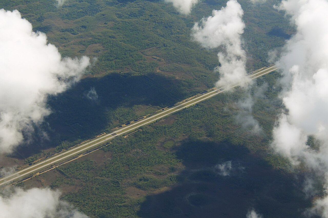
I-75 (Alligator Alley) crossing the Everglades, Florida
I-75 (Alligator Alley) crossing the Everglades, Florida formulanone (Flickr) / Wikimedia Commons · CC BY-SA 2.0
01 Route overview

Interstate 75 runs 1,786 miles from Miami, Florida to Sault Ste. Marie, Michigan at the Canadian border, making it the longest north-south interstate east of the Mississippi. It serves the Florida population centers, the Atlanta industrial belt, and the Cincinnati, Toledo, and Detroit auto-manufacturing corridor before terminating at the International Bridge into Ontario.

For freight, I-75 is the main freight route for the southeastern automotive supply chain and the main route for Florida-bound produce, snowbird traffic, and Detroit-Florida finished-vehicle moves. The Atlanta segment, especially through downtown and along the I-285 outerbelt, is among the most congested in the country. The Cincinnati Brent Spence Bridge over the Ohio River is a chronic chokepoint that has driven a major federally-funded replacement project.

Geographically I-75 is mostly rolling, with the only significant climbs through the Cumberland Plateau in northern Tennessee and Kentucky, and the moderate Appalachian foothills in northern Georgia. Weather hazards are dominated by Florida summer thunderstorms, lake-effect snow in northern Ohio and Michigan, and occasional ice events in the central segment.

  • Longest north-south interstate east of the Mississippi
  • Second-longest north-south interstate in the US, after I-95 (Wikipedia)
  • Crosses six states: FL, GA, TN, KY, OH, MI
  • Main snowbird and produce corridor between Detroit and Florida
  • Atlanta segment ranks among the nation's worst truck bottlenecks (I-75 at I-285 North, 5th nationally; ATRI 2026)
  • Brent Spence Bridge at Cincinnati is a federally-funded replacement priority
  • Concurrent with I-85 from Atlanta north to the South Carolina line
  • Reaches the Canadian border at Sault Ste. Marie, MI
02 Key cities & junctions
StateMileCity / Junction
FL MM 0 Hialeah / Miami
FL MM 23 Naples (I-75 turns north)
FL MM 116 Fort Myers
FL MM 256 Tampa (I-275 jct)
FL MM 341 Ocala
FL MM 435 Lake City (I-10 jct)
GA MM 5 Valdosta
GA MM 101 Tifton
GA MM 165 Macon (I-16 jct)
GA MM 247 Atlanta (I-20/I-85/I-285 jct)
GA MM 348 Dalton
TN MM 1 Chattanooga (I-24 jct)
TN MM 80 Cleveland, TN
TN MM 144 Knoxville (I-40/I-81 jct)
KY MM 25 Corbin
KY MM 76 London
KY MM 121 Lexington (I-64 jct)
KY MM 192 Florence
OH MM 1 Cincinnati (Brent Spence Bridge)
OH MM 60 Dayton (I-70 jct)
OH MM 144 Lima
OH MM 211 Toledo (I-80/I-90 jct)
MI MM 16 Monroe
MI MM 43 Detroit (I-94/I-696 jct)
MI MM 153 Flint
MI MM 252 Bay City
MI MM 392 Sault Ste. Marie / Canadian Border
04 Notable hazards & trouble spots
Hazard

Among the nation's worst truck bottlenecks (I-75 at I-285 North ranks 5th, ATRI 2026)

Atlanta I-75 / I-85 / I-285 (MM 240-260)

I-75 through downtown Atlanta merges with I-85 to form the Downtown Connector: eight to ten lanes that still see chronic congestion. The I-285 perimeter is the through-truck route for most Atlanta-bypassing freight. GDOT publishes real-time conditions.

Hazard

Major chokepoint with replacement project underway

Brent Spence Bridge, Cincinnati, OH (MM 1)

The double-deck Brent Spence Bridge carries I-75 and I-71 across the Ohio River into Cincinnati. Functionally obsolete and chronically congested, it has been the subject of a major federally-funded replacement project. It was designed for 85,000 vehicles per day but was already carrying about 150,000 per day by 2006 (Wikipedia). Lane closures during construction phases will continue for years.

Hazard

Severe storms with hail and waterspouts

Florida summer thunderstorms (MM 0-435)

Florida's summer convective season produces sudden, intense thunderstorms that can drop visibility to near zero and produce hail that damages truck windshields. Pull off and wait. Florida storms typically pass in under an hour.

Hazard

Steep grades through the Cumberland Mountains

Cumberland Plateau, TN (MM 144-200)

The 60-mile climb between Knoxville and the Kentucky line crests at the Jellico summit. Frequent rain, fog, and ice in winter make this segment one of the most incident-prone in the East. Runaway-truck ramps line both descents.

Hazard

Lake-effect snow squalls

Detroit / Toledo lake-effect (MM 211 OH - 60 MI)

I-75 between Toledo and Detroit is exposed to severe lake-effect snow off Lake Erie. Squalls can drop visibility to zero in minutes and have caused multi-vehicle pile-ups. ODOT and MDOT publish real-time alerts.

4a Passes and chain laws on this route

The passes on Interstate 75 with a full guide: grade, chain-control season, closures and hazards. The status is the state DOT's latest reading.

Chain rules for the states these passes are in, and for every state on the route that has a chain law:

All US mountain pass conditions →

05 Active incidents (36)
CONSTRUCTION OH

I-75 N to SR 55 northbound.

I-75 N to SR 55

CONSTRUCTION OH

Westboundern Avenue on ramp to I-75 Southbound.

Western Avenue on ramp to I-75 South

CONSTRUCTION OH

Wagner-Ford Road to I-75 Southbound .

Wagner-Ford Road to I-75 South

CONSTRUCTION GA

roadwork

I-75

CLOSURE GA

closures

I-75

CONSTRUCTION OH

The Southbound GMR walk between I-75 and SR 48.

The South GMR walk between I-75 and SR 48

CONSTRUCTION FL

I-75 NB Mill&Resurf - Area 4

I 75

CONSTRUCTION FL

E54F5: I-75 SB Mill&Resurf - Area4

I 75

CONSTRUCTION FL

I-75 SB Aux Lane Ramp Closure - Area 2

I 75

CONSTRUCTION FL

I-75 NB Aux Lane Ramp Closures - Area 2

I 75

CONSTRUCTION FL

I-75 NB Mill&Resurf - Area 3

I 75

CONSTRUCTION FL

I-75 SB Mill&Resurf - Area 3

I 75

CONSTRUCTION FL

I-75 NB Mill&Resurf - Area 1

I 75

CONSTRUCTION FL

I-75 SB Mill&Resurf - Area1

I 75

CONSTRUCTION FL

I-75 NB Aux Lane Ramp Closures - Area 1

I 75

CONSTRUCTION FL

I-75 SB Aux Lane Ramp Closures - Area 1

I 75

CONSTRUCTION FL

I-75 NB Aux Lane Ramp Closures - Areas 3 & 4

I 75

CONSTRUCTION FL

I-75 SB Closure - Areas 3 & 4

I 75

Showing 18 of 36. View all on map →

06 Weather alerts in its states (3)

National Weather Service alerts in force in the states Interstate 75 runs through. Each one covers a county or a forecast zone, which may be far from the Interstate.

  • 3 alerts in Florida: Coastal Flood Advisory

See where each alert is on the live map →

07 FAQ
How long does it take to drive I-75 end to end?
A passenger car can cover the 1,786 miles in 27-30 hours of driving time. Commercial drivers respecting hours-of-service rules typically need 3 to 4 days, with delays common in the Atlanta, Cincinnati, and Detroit metros.
Is I-75 a toll road?
No. I-75 is toll-free for its entire 1,786-mile length. Optional adjacent express lanes (the I-75 Express in Florida, the I-75 South Metro Express in Atlanta) carry tolls but the general-purpose lanes are free.
What major cities does I-75 connect?
I-75 directly serves Miami, Naples, Fort Myers, Tampa, Ocala, Valdosta, Macon, Atlanta, Chattanooga, Knoxville, Lexington, Cincinnati, Dayton, Toledo, Detroit, Flint, and Sault Ste. Marie.
Does I-75 close in winter?
Rarely in the southern half. Lake-effect snow events on the Toledo-Detroit segment and ice storms in northern Tennessee and Kentucky can shut down sections for 12-24 hours. The Florida segment is essentially never closed for snow.
Where does I-75 end?
I-75 begins in Hialeah, Florida (north of Miami) and ends at the International Bridge in Sault Ste. Marie, Michigan, which crosses into Sault Ste. Marie, Ontario.

Interstate 75 Live Map

See every incident, alert, and road condition on Interstate 75 in real time.

Open Live Map