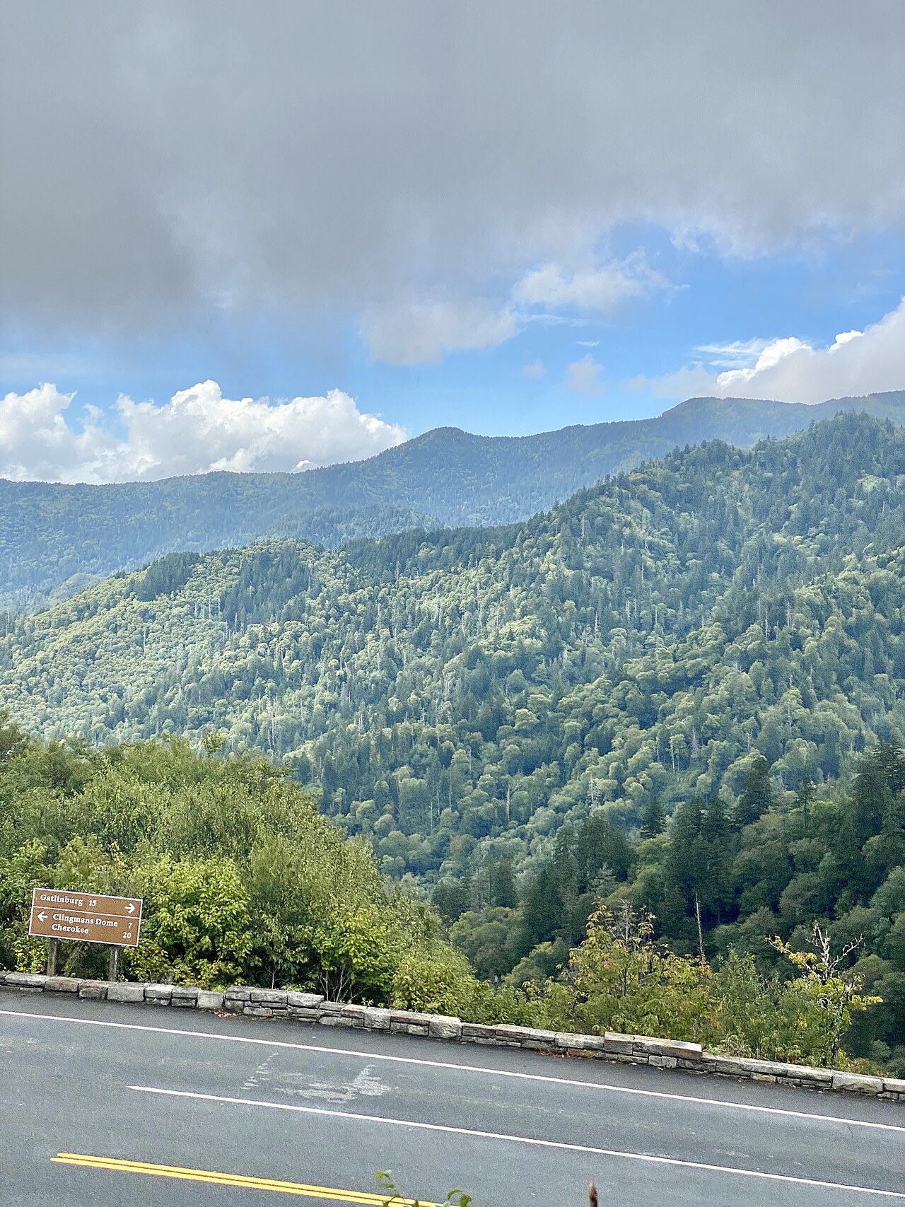
Newfound Gap Road is US-441 across Great Smoky Mountains National Park, running about 31 miles between Gatlinburg, Tennessee and Cherokee, North Carolina (NPS; National Scenic Byway Foundation). It tops out at the gap itself, around 5,046 feet, which Wikipedia lists as 5,048 feet. That makes it the lowest drivable pass across the Smokies. It is a scenic National Park road with a hairpin and an engineered "Loop Over" bridge where the road crosses over itself.
Here is the part that matters if you drive a truck: this is not a legal route for you. Commercial vehicles are permanently banned on US-441 through the park, with the exception of the Spur. It is a National Park Service road, not a state DOT highway. There is no chain-control program, no brake-check area, and no runaway truck ramp anywhere on it. The Park Service bans big rigs because the road is two-lane with steep continuous grades, tight curves, and nowhere for a large vehicle to slow down or pull over (NPS).
The reason this page exists is GPS. Navigation apps keep routing trucks onto US-441 as a shortcut between the Tennessee side near Gatlinburg and the North Carolina side, especially when I-40 through the Pigeon River Gorge is closed. The Park Service turns those trucks around at checkpoints and writes citations. A violation carries a fine of up to $5,000 (NPS). If your GPS sends you over Newfound Gap, it is wrong, and the cost of following it is real.
- Commercial vehicles are permanently banned on US-441 through the park, except the Spur; a violation carries a fine of up to $5,000 (NPS).
- The road runs about 31 miles from Gatlinburg, TN to Cherokee, NC; the Tennessee portion of the scenic byway is 14.5 of those miles (NPS; National Scenic Byway Foundation).
- Summit elevation at the gap is about 5,046 feet, listed as 5,048 feet by Wikipedia; it is the lowest drivable pass across the Smokies.
- Base elevations are about 1,289 feet at Gatlinburg, TN and about 2,100 feet at the Oconaluftee Visitor Center near Cherokee, NC, so the climb runs roughly 3,000 feet or more from each side (Wikipedia; NPS).
- Newfound Gap averages about 19 snowy days a year, with annual snowfall ranging 43.5 to 106 inches from 1991 to 2005 (Wikipedia citing NWS data).
- In 2024 the Park Service opened 24-hour checkpoints and turned away over 800 commercial vehicles trying to use the road as a detour (Landline; NPS).
- There is no chain-control program, no brake-check area, and no runaway truck ramp on the road because it is an NPS road, not a state DOT highway (NPS).