Interstate 70 runs 2,153 miles from Cove Fort, Utah to Baltimore, Maryland, crossing the Rockies, the central Plains, the Mississippi River, the Ohio Valley, and the Appalachian foothills. Among long east-west interstates, I-70 crosses the most varied terrain: it climbs through the Eisenhower-Johnson Memorial Tunnel at 11,158 ft (the highest point on any US interstate), and follows the route of the historic National Road across the eastern half.
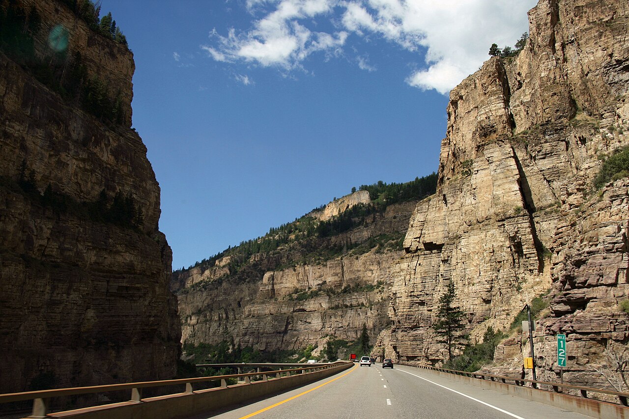
The Colorado segment between Denver and Grand Junction ranks among the most demanding mountain driving on the Interstate System. CDOT recorded 99 full closures of I-70 in 2024 totaling 161 hours (Colorado Sun). The Colorado State Patrol tracks roughly 900 to 1,000 crashes a year along the I-70 mountain corridor, about 15 percent involving a commercial vehicle (Colorado Sun, citing Colorado State Patrol). The Vail Pass, Eisenhower Tunnel, Glenwood Canyon, and the steep descents into Idaho Springs combine high elevation, severe grades, frequent closures for rockfall and avalanche control, and seasonal chain controls. The 2.7-mile Eisenhower-Johnson Tunnel itself prohibits HAZMAT loads. Placarded trucks must use the US-6 Loveland Pass detour.
East of the Rockies, I-70 rolls across Kansas as one of the flattest sustained interstate segments in the country, climbs into the Ozark foothills around St. Louis, threads the Indianapolis interchange complex, and descends the Allegheny Plateau into Pennsylvania and Maryland. The terminus in Baltimore is unusual. I-70 ends at a park-and-ride lot with no direct connection to I-95.
- Highest elevation on any US interstate: Eisenhower-Johnson Tunnel (11,158 ft)
- Crosses ten states: UT, CO, KS, MO, IL, IN, OH, WV, PA, MD
- Glenwood Canyon (CO) is 13 miles of bridges, tunnels, and elevated decks built into a river canyon
- Eisenhower-Johnson Tunnel is the longest mountain tunnel on the Interstate System (Wikipedia)
- HAZMAT loads prohibited in Eisenhower Tunnel; must use US-6 Loveland Pass
- Concurrent with I-76 across Pennsylvania (Pennsylvania Turnpike)
- Crosses the Mississippi River at St. Louis
- Eastern terminus is a park-and-ride lot in Baltimore; does not reach I-95 directly