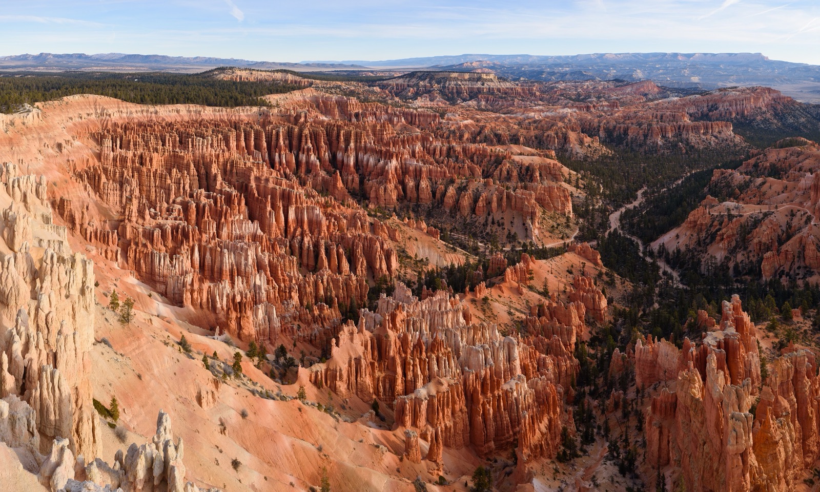
Bryce Canyon is the densest concentration of hoodoos (irregular pillars of weathered limestone) anywhere on earth, packed into a series of horseshoe-shaped natural amphitheaters along the eastern edge of the Paunsaugunt Plateau. It is technically not a canyon at all but a row of erosional bowls that drop 1,000-2,000 feet from a 8,000-9,000 foot rim into a forest of pink and orange spires. Designated a national park in 1928, Bryce sits at high elevation, visitors typically need an extra day to acclimate before doing rim-to-floor hikes. From I-15 the standard route is Exit 95 in Beaver, then 85 miles east on UT-20, US-89, and UT-12 to the park entrance. Bryce is one of the certified International Dark Sky Parks with some of the darkest measured skies in the contiguous US.
- Densest concentration of hoodoos on earth, over 10,000 pillars in the main Bryce Amphitheater alone
- Rim elevations range from 8,000 to 9,100 ft
- Designated an International Dark Sky Park in 2019 (Gold Tier)
- ~2.5 million visitors per year
- The park is part of Utah's "Mighty 5" alongside Zion, Capitol Reef, Arches, and Canyonlands