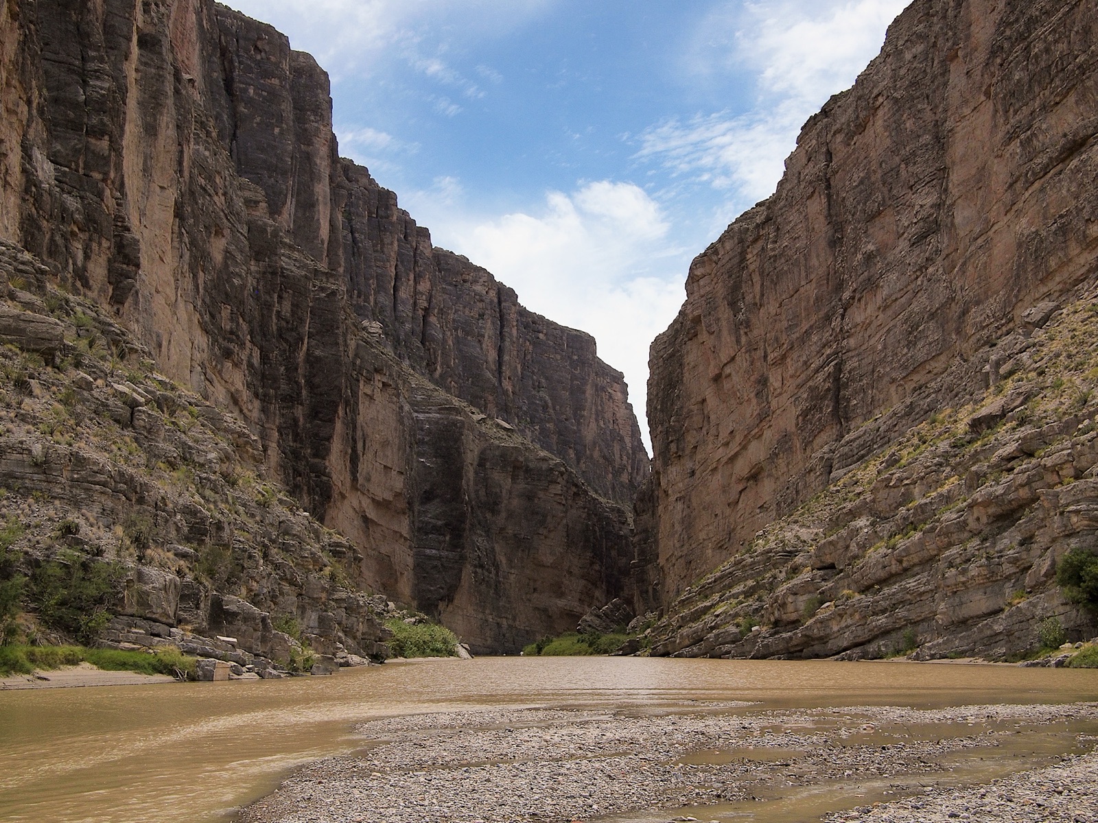
Big Bend protects 800,000 acres of the most remote landscape in the contiguous United States, the great southern bend of the Rio Grande forms the entire 118-mile international boundary of the park, and the Chisos Mountains rise 4,000 ft above the Chihuahuan Desert floor as the only mountain range entirely within a US national park. There are no major cities within 200 miles. The park sees about 500,000 visitors per year (a fraction of what the marquee parks pull) and has an International Dark Sky Park designation rated among the very darkest in North America. The standard route from any direction is through Fort Stockton on I-10 (Exit 257), then 130 mi south on US-385 to the Persimmon Gap (north) Entrance. The Maverick (west) Entrance is reached by US-67 from Marfa via TX-118.
- Largest protected stretch of Chihuahuan Desert in the US (800,000 acres)
- 118 miles of Rio Grande border with Mexico, entire southern park boundary
- Chisos Mountains: only mountain range entirely within a US national park
- Designated an International Dark Sky Park, among the darkest measured skies in North America
- About 500,000 visitors per year; nearest interstate (I-10) is 130 mi away