Is I-77 closed right now?
Yes, in one place. As of , the state DOT feeds we collect show 1 closure on I-77 in North Carolina. This answer does not cover Virginia (our feed has sent nothing in the last 3 hours).
Yes, in one place. As of , the state DOT feeds we collect show 1 closure on I-77 in North Carolina. This answer does not cover Virginia (our feed has sent nothing in the last 3 hours).
Our feeds show 0 closures, 0 crashes and 2 work zones on I-77 in South Carolina.
South Carolina road conditions →Our feeds show 1 closure, 0 crashes and 0 work zones on I-77 in North Carolina.
Our Virginia feed has sent nothing in the last 3 hours, so this page cannot count what is on I-77 there.
Virginia road conditions →Our feeds show 0 closures, 0 crashes and 7 work zones on I-77 in West Virginia.
West Virginia road conditions →Our feeds show 0 closures, 0 crashes and 12 work zones on I-77 in Ohio.
Ohio road conditions →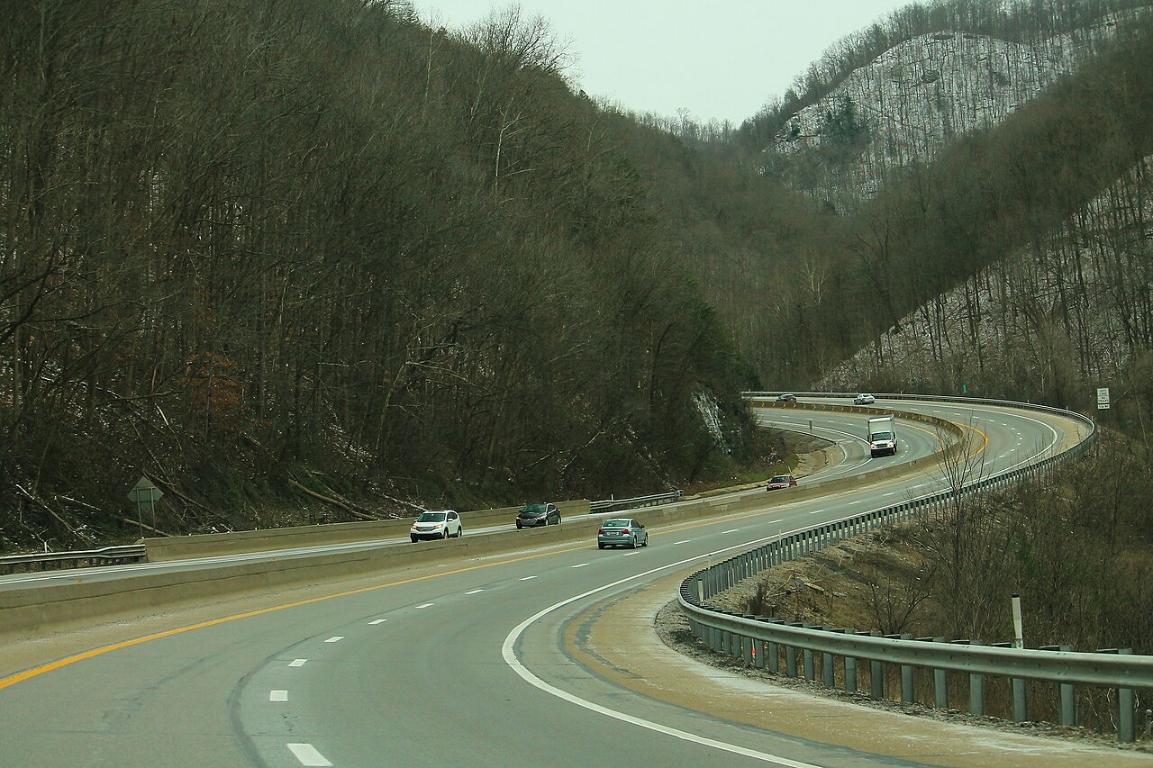
Interstate 77 runs from I-26 in Cayce, on the south side of Columbia, South Carolina, to I-90 in downtown Cleveland, Ohio. The FHWA route log puts it at 606.78 miles through South Carolina, North Carolina, Virginia, West Virginia and Ohio. The hard part for a truck is the roughly 170 miles between the North Carolina line and Charleston, West Virginia.
That stretch starts with the Fancy Gap grade in Carroll County, Virginia, where I-77 climbs the Blue Ridge for about six miles from the state line. Fog is the main danger there. Virginia State Police counted 95 vehicles in 17 crashes on the southbound side in one afternoon in March 2013, and VDOT now runs variable speed limits over the first 12 miles of the Virginia segment. Wind is the second danger: VDOT has told high-profile trucks to stay off the mountain during blow-over events. North of Fancy Gap, I-77 shares about 8 miles with I-81 near Wytheville, then goes under Big Walker Mountain and East River Mountain in two twin-bore tunnels. The East River tunnel straddles the West Virginia line.
In West Virginia, I-77 follows the West Virginia Turnpike for 88 miles from Princeton to Charleston. A 5-axle truck pays at three mainline toll plazas, and the road climbs past 3,400 feet at Flat Top Mountain. I-64 joins at exit 40 near Beckley and leaves at exit 101 in Charleston. North of Charleston the road is toll-free through Parkersburg, across the Ohio River at Marietta, and up through Cambridge, Canton and Akron. The NWS office in Cleveland calls the hills between Akron and Cleveland the secondary snowbelt, so lake-effect snow can reach the last 40 miles of the route.
In Charlotte, the 26 miles of I-77 Express Lanes are closed to anything with more than two axles, so tractor-trailers stay in the general lanes.
| State | Mile | City / Junction |
|---|---|---|
| SC | MM 0 | Cayce / Columbia (I-26 jct, southern end) |
| SC | MM 16 | Columbia (I-20 jct) |
| SC | MM 79 | Rock Hill (SC 122, Dave Lyle Blvd) |
| NC | MM 13 | Charlotte (I-85 jct) |
| NC | MM 36 | Mooresville (NC 150) |
| NC | MM 51 | Statesville (I-40 jct) |
| NC | MM 73 | US 421 (Yadkinville / Wilkesboro) |
| NC | MM 100 | Mount Airy (NC 89) |
| VA | MM 8 | Fancy Gap (Blue Ridge Parkway access) |
| VA | MM 14 | Hillsville / Galax (US 58/US 221) |
| VA | MM 32 | Fort Chiswell (I-81 jct, overlap begins) |
| VA | MM 41 | Wytheville (overlap ends at exit 40) |
| VA | MM 48 | Big Walker Mountain Tunnel |
| VA | MM 66 | East River Mountain Tunnel / WV line |
| WV | MM 1 | Bluefield (US 52) |
| WV | MM 9 | Princeton (US 460), Turnpike begins |
| WV | MM 40 | I-64 east to Lewisburg (I-64 joins) |
| WV | MM 44 | Beckley (WV 3) |
| WV | MM 101 | Charleston (I-64 west to Huntington) |
| WV | MM 104 | Charleston (I-79 jct) |
| WV | MM 138 | Ripley (US 33) |
| WV | MM 176 | Parkersburg (US 50) |
| OH | MM 1 | Marietta (SR 7) |
| OH | MM 44 | Cambridge (I-70 jct) |
| OH | MM 104 | Canton (US 30) |
| OH | MM 125 | Akron (I-76 east / SR 8) |
| OH | MM 146 | Ohio Turnpike (I-80 jct) |
| OH | MM 163 | Cleveland (I-90 jct, northern end) |
Fancy Gap Mountain, VA (mileposts 0 to 12)
Fog on this grade has caused a string of chain-reaction pileups. A Virginia Transportation Research Council (VTRC) report lists 56 vehicles on February 14, 1997, more than 70 vehicles and 2 deaths on November 16, 2010, and the worst so far on March 31, 2013. That afternoon, Virginia State Police said, 95 vehicles crashed in 17 separate wrecks within about a mile of the southbound descent near mile marker 6. Three people died and more than two dozen went to hospitals. A study cited by VTRC found 84% of fog-related crashes between mileposts 0 and 15 were southbound, on the downhill side. Since October 2016, VDOT has run a variable speed limit system over mileposts 0 to 12, with 14 weather stations reading visibility and 36 overhead speed displays. The limit drops from 65 mph to as low as 30 mph, and it is a legal limit. If the signs show 45 or 30 southbound, expect to drive into fog you cannot yet see.
Fancy Gap Mountain, VA (mile markers 0 to 10)
High winds on Fancy Gap Mountain have tipped tractor-trailers. In its December 23, 2022 advisory, VDOT told high-profile vehicles, including tractor-trailers and box trucks, and commercial vehicles with loads under 25,000 pounds to seek alternate routes or postpone travel on I-77 between mile markers 0 and 10 until the wind dropped. VDOT posts these warnings on the message boards along I-77 and on 511 Virginia. If you are running empty or light, check 511 before you leave Mount Airy northbound or Hillsville southbound.
Big Walker Mountain and East River Mountain tunnels, VA/WV (VA mileposts 47 to 49 and 66)
Each tunnel has two tubes, one for each direction. Virginia classifies them as rural tunnels, and under 24VAC30-61-30 hazmat may go through as long as the shipment complies with 49 CFR Parts 100 to 180. The Commissioner of Highways can impose a temporary hazmat restriction, with signs placed far enough ahead to allow a detour. For permitted oversize loads, the Virginia DMV hauling permit rules (Form MP 227, revised August 14, 2026) cap the tunnels at 14 ft 0 in wide and 16 ft 0 in high. VDOT does tunnel maintenance at night, sometimes with one tube closed and both directions running through the other, so check the Bristol District traffic alerts before a night run.
West Virginia Turnpike, Princeton to Charleston (WV exits 9 to 96)
The West Virginia Parkways Authority lists three mainline toll plazas: Ghent at milepost 30, Pax at 56 and Chelyan at 83. There is a fourth plaza on US 19 at the North Beckley exit (exit 48). As of September 2026, a 5-axle truck pays $15.00 cash, $12.00 with a West Virginia E-ZPass commercial account, or $13.00 with an E-ZPass from another state, at each plaza. A full run through all three costs $45.00 cash. The road climbs from about 600 ft near Charleston to more than 3,400 ft at Flat Top Mountain, so winter weather on the summit can be much worse than what you see in Charleston.
I-77 Express Lanes, Charlotte, NC
The 26 miles of tolled express lanes from uptown Charlotte toward Mooresville are run by I-77 Mobility Partners. Vehicles with more than two axles, and two-axle vehicles pulling a trailer with two or more axles, may not use them (NC Quick Pass). A tractor-trailer stays in the general lanes, which carry the Charlotte congestion.
Akron to Cleveland, OH (about mileposts 125 to 163)
The National Weather Service office in Cleveland calls the hills between Cleveland and Akron the secondary snowbelt. In the January 19-20, 2024 storm, northerly flow off Lake Erie dropped 8 to 12 inches there while most of the region got 3 to 6. Check NWS Cleveland and OHGO before you head north of Akron on a winter night.
The passes on or next to Interstate 77 with a full guide: grade, chain-control season, closures and hazards. Next to each is what its own page shows right now, with the agency the reading comes from where there is one.
Chain rules for the states these passes are in, and for every state on the route that has a chain law:
ACC contractor
I-77 Southbound
E. 14th St. to I-77 SB southbound.
E. 14th St. to I-77 SB
I-77 northbound to E. 22nd/E.14th
I-77 northbound to E. 22nd/E.14th
I-77 northbound to E. 22nd/E.14th
I-77 northbound to E. 22nd/E.14th
Ramp US-224 Westbound to I-77 Southbound.
Ramp US-224 West to I-77 South
Ramp from I-77 northbound to I-277/US 224 westbound.
Ramp from I-77 north to I-277/US 224 west
Washington I-77 southbound.
Washington I-77
I-77 NB to I-480 eastbound.
I-77 NB to I-480
I-77 in the City of Akron northbound.
I-77 in the City of Akron
I-77 in the City of Akron southbound.
I-77 in the City of Akron
construction work
I-77
construction work
I-77
construction work
I-77
See every incident, alert, and road condition on Interstate 77 in real time.
Open Live Map