← All Interstates
Interstate No. 45 No active incidents

I-45: The Houston-Dallas Corridor

Interstate 45 runs 285 miles entirely within Texas from Galveston on the Gulf of Mexico to Dallas. It is the only interstate that connects the two largest Texas metro areas. It is the second-shortest of the primary interstates and is unusual for being entirely contained within a …

0Incidents
3Alerts in its states
1States
4Hazards
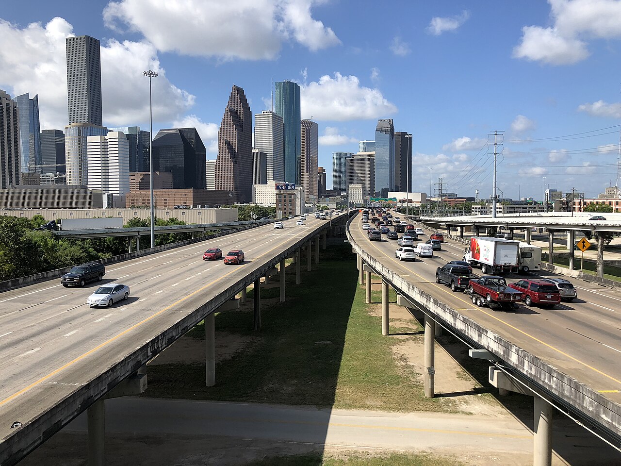
I-45 (North Freeway) heading south into Houston, Texas
I-45 (North Freeway) heading south into Houston, Texas Famartin / Wikimedia Commons · CC BY-SA 4.0
01 Route overview

Interstate 45 runs 285 miles entirely within Texas from Galveston on the Gulf of Mexico to Dallas. It is the only interstate that connects the two largest Texas metro areas. It is the second-shortest of the primary interstates and is unusual for being entirely contained within a single state.

For freight, I-45 is a major Texas corridor, linking the Port of Houston (the nation's largest port by total waterborne tonnage, 275.9 million short tons in 2023 per USACE) with the Dallas-Fort Worth distribution hubs. Multiple I-45 interchanges in Houston rank on ATRI's national list of the worst truck bottlenecks (ATRI 2024). The Houston segment ranks among the worst truck bottlenecks in the country: I-45 at I-69/US 59 is the 4th-worst truck bottleneck nationally (ATRI 2024), with two more I-45 Houston interchanges also in the top 100. The I-45 Pierce Elevated reconstruction (the North Houston Highway Improvement Project) has been controversial for displacing thousands of residents. Houston's I-10 at I-45 interchange is separately the 8th-worst truck bottleneck in the country, so the city has two of the nation's top 10 truck bottlenecks adjacent to I-45 (ATRI 2024).

Geographically I-45 is entirely flat, crossing the Texas coastal plain. Weather hazards are dominated by hurricane evacuations from Galveston and the Houston metro, severe spring weather across the central segment, and the persistent flooding that affects the Houston Bayou City area.

  • Only US interstate entirely within a single state (Texas)
  • Connects Galveston (Gulf) to Dallas (285 miles)
  • Houston segment ranks among the nation's worst truck bottlenecks (I-45 at I-69/US 59 is #4 nationally, ATRI 2024)
  • Designated hurricane evacuation route for Galveston and Houston
  • Concurrent with no other interstate for any meaningful distance
  • Toll-free across its entire 285-mile length
  • Houston holds 33 of Texas's 100 most congested road segments; the I-45 Gulf Freeway (I-10 to I-610) entered the statewide top 10 in 2025 (TxDOT)
  • Pierce Elevated reconstruction project displaced thousands of Houston residents
02 Key cities & junctions
StateMileCity / Junction
TX MM 0 Galveston
TX MM 12 Texas City
TX MM 27 League City
TX MM 43 Houston (I-610 South Loop)
TX MM 49 Houston (downtown / I-10 jct)
TX MM 60 Houston (I-610 North Loop)
TX MM 70 Spring
TX MM 116 Huntsville
TX MM 158 Centerville
TX MM 198 Corsicana
TX MM 257 Ennis
TX MM 285 Dallas (I-30/I-345 jct)
04 Notable hazards & trouble spots
Hazard

Chronic congestion and flooding

Houston metro (MM 27-70)

I-45 through Houston ranks among the nation's worst truck bottlenecks: the I-45 / I-69-US 59 interchange is the 4th-worst in the US (ATRI 2024), where trucks average about 30 mph. The Pierce Elevated section through downtown also floods during major rain events. Plan deliveries outside the 6-10 AM and 3-8 PM peaks.

Hazard

Mandatory northbound contraflow during major hurricanes

Hurricane evacuation contraflow (MM 0-70)

When a major hurricane threatens Galveston or the Houston metro, TxDOT reverses the southbound lanes of I-45 to send all traffic north toward Dallas. Trucks face long delays and may be ordered off the road. Monitor TranStar and TxDOT DriveTexas.

Hazard

Tornado and storm corridor

Spring severe weather (MM 70-285)

I-45 across central Texas runs through the eastern fringe of Tornado Alley. Severe spring storms with damaging hail and tornadoes are routine April through June.

Hazard

Storm-surge vulnerable approach

Galveston causeway flooding (MM 0-15)

The I-45 causeway between Galveston and the Texas mainland is at sea level and vulnerable to storm-surge flooding during hurricanes and tropical storms. The causeway is closed pre-emptively when major storms approach.

05 Active incidents
No active incidents on Interstate 45 right now. State DOT feeds are read every 15 minutes and this page is rebuilt every 30 minutes.
06 Weather alerts in its states (3)

National Weather Service alerts in force in the states Interstate 45 runs through. Each one covers a county or a forecast zone, which may be far from the Interstate.

  • 3 alerts in Texas: Coastal Flood Advisory, Coastal Flood Statement

See where each alert is on the live map →

07 FAQ
How long does it take to drive I-45 end to end?
Under good conditions a passenger car covers the 285 miles in about 4-5 hours. Commercial drivers respecting hours-of-service rules typically complete the route in a single day. Houston congestion can add 1-2 hours during peaks.
Is I-45 a toll road?
No. I-45 itself is toll-free. Adjacent toll routes exist around Houston (Sam Houston Tollway, Hardy Toll Road, Westpark Tollway) but they are separate routes.
Why is I-45 entirely within Texas?
I-45 is unique among major US interstates for being entirely contained within a single state. Its 285-mile route runs from Galveston (Gulf of Mexico) to Dallas, with no out-of-state extensions planned.
What major cities does I-45 connect?
I-45 directly serves Galveston, Texas City, Houston, Spring, Huntsville, Corsicana, and Dallas.

Interstate 45 Live Map

See every incident, alert, and road condition on Interstate 45 in real time.

Open Live Map