← All Interstates
Interstate No. 35 98 live incidents

I-35: The NAFTA Corridor

Interstate 35 is the main north-south freight route through the central US, running 1,568 miles from Laredo, Texas at the Mexican border to Duluth, Minnesota on Lake Superior. It is the busiest land port-of-entry corridor with Mexico (Laredo is the busiest US-Mexico land port for…

98Incidents
15Alerts in its states
6States
5Hazards
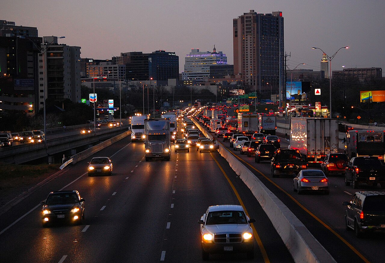
I-35 alongside the downtown Austin skyline at dusk, Texas
I-35 alongside the downtown Austin skyline at dusk, Texas LoneStarMike / Wikimedia Commons · CC BY-SA 3.0
01 Route overview

Interstate 35 is the main north-south freight route through the central US, running 1,568 miles from Laredo, Texas at the Mexican border to Duluth, Minnesota on Lake Superior. It is the busiest land port-of-entry corridor with Mexico (Laredo is the busiest US-Mexico land port for trucks, handling 3,026,632 truck crossings in 2024, about 38.8 percent of all inbound trucks from Mexico per the Bureau of Transportation Statistics; the Texas Comptroller reports the same 2024 count) and the only interstate that splits into two parallel routes (I-35E through Dallas and I-35W through Fort Worth in Texas; I-35E through St. Paul and I-35W through Minneapolis in Minnesota).

The route carries much of the NAFTA / USMCA freight moving between Mexico and the upper Midwest. Auto parts, electronics, and produce flow north from Mexico through Laredo into the Texas Triangle, the Kansas City and Des Moines logistics hubs, and the Twin Cities. South-bound flows are dominated by grain, machinery, and raw materials. Texas DOT data routinely shows I-35 segments through Austin, Dallas-Fort Worth, and the Hillsboro split among the highest truck-volume corridors in the United States.

Geographically I-35 is mostly flat with rolling terrain through the Texas Hill Country, a long climb over the Wichita Mountains in southern Oklahoma, and gentler rolling country through Kansas, Missouri, Iowa, and Minnesota. Weather hazards skew toward severe thunderstorms, tornadoes (the corridor crosses the heart of Tornado Alley between Oklahoma City and Wichita), and winter ice across the central Plains.

  • Feeds Laredo, the busiest US-Mexico truck gateway (3,026,632 crossings in 2024, BTS)
  • Laredo truck crossings rose 3.1 percent from 2023 to 2024 (Texas Comptroller, BTS data)
  • Splits into I-35E and I-35W in both Texas (DFW) and Minnesota (Twin Cities)
  • Crosses six states: TX, OK, KS, MO, IA, MN
  • Designated NAFTA / USMCA priority freight corridor
  • Concurrent with no other interstate for any significant distance
  • Primary NAFTA freight corridor through the central US
  • Crosses the Red River at Gainesville/Marietta and the Mississippi at St. Paul
02 Key cities & junctions
StateMileCity / Junction
TX MM 0 Laredo / Mexican Border
TX MM 154 San Antonio (I-10/I-410 jct)
TX MM 230 Austin
TX MM 281 Temple
TX MM 339 Waco
TX MM 369 Hillsboro / I-35 split
TX MM 408 Fort Worth (I-35W) / Dallas (I-35E)
TX MM 469 Denton (I-35 reconverges)
OK MM 22 Ardmore
OK MM 109 Norman
OK MM 124 Oklahoma City (I-40 jct)
KS MM 4 Wichita (I-235 jct)
KS MM 127 Emporia
KS MM 235 Kansas City (I-70/I-435 jct)
MO MM 8 Kansas City, MO (I-29 jct)
IA MM 12 Lamoni
IA MM 92 Des Moines (I-80 jct)
IA MM 169 Mason City
MN MM 12 Albert Lea
MN MM 89 Twin Cities split
MN MM 130 Minneapolis (I-35W) / St. Paul (I-35E)
MN MM 219 Hinckley
MN MM 259 Duluth
04 Notable hazards & trouble spots
Hazard

Chronic congestion, frequent incidents

Austin metro (MM 220-260)

I-35 through Austin ranks among the worst truck bottlenecks in the country, No. 51 in ATRI's 2026 Top 100 Truck Bottlenecks (No. 54 in 2024) and the highest-ranked Texas bottleneck on that list, with peak truck speeds down to about 21.7 mph (ATRI 2026). Reconstruction is continuous. The lower decks through downtown have frequent incidents. Plan delivery windows outside 6-10 AM and 3-8 PM.

Hazard

Choose your route at Hillsboro

I-35E / I-35W split, TX (MM 369-469)

Northbound trucks must choose between I-35E (Dallas) and I-35W (Fort Worth) at Hillsboro and again pick a side approaching Denton. Most freight bound for east of I-45 takes I-35E; west of I-45 takes I-35W. Traffic information is published separately for each split.

Hazard

Severe weather corridor

Tornado Alley (MM 0 OK - 250 KS)

I-35 from Oklahoma City through Wichita and Kansas City crosses the heart of Tornado Alley. Severe thunderstorms with damaging hail and tornadoes are routine April through June. Plan to park under solid shelter when warnings are issued; do not stop under highway overpasses.

Hazard

Ground blizzards and ice on flat terrain

Iowa / southern Minnesota winter (MM 0 IA - 89 MN)

The 250 miles between Des Moines and the Twin Cities are flat and exposed. Ground blizzards with 0-visibility whiteouts can develop in minutes. Iowa DOT and MnDOT both close I-35 several times per winter. Chain laws apply to commercial vehicles when posted.

Hazard

Different routes through Minneapolis vs. St. Paul

Twin Cities I-35E / I-35W split (MM 89-130)

I-35 splits at Burnsville, MN: I-35E serves St. Paul and reconnects at Forest Lake; I-35W serves Minneapolis and reconnects at the same point. Most westbound and northbound freight uses I-35W; northbound bound for the I-94 east split uses I-35E.

05 Active incidents (98)
CONSTRUCTION MN

Work Zone on I-35E

I-35E

CONSTRUCTION MN

Work Zone on I-35E

I-35E

CONSTRUCTION OK

RESURFACE

I-35 N

CONSTRUCTION OK

WEIGH STATION

I-35 S, Weigh Station

CONSTRUCTION OK

GRADE, DRAIN, SURFACE, AND BRIDGE

I-35 S, I-35 N

CONSTRUCTION MN

Work Zone on I-35E

I-35E

CONSTRUCTION MN

Work Zone on I-35

I-35

CONSTRUCTION MN

Work Zone on I-35

I-35

CONSTRUCTION MN

Work Zone on I-35E

I-35E

CONSTRUCTION MN

Work Zone on I-35E

I-35E

CONSTRUCTION MN

Work Zone on I-35

I-35

CONSTRUCTION MN

Work Zone on I-35

I-35

CONSTRUCTION MN

Work Zone on I-35E

I-35E

CONSTRUCTION MN

Work Zone on I-35E

I-35E

CONSTRUCTION MN

Work Zone on I-35E

I-35E

CONSTRUCTION KS

Bridge Construction

I-35

CONSTRUCTION KS

Bridge Construction

I-35

CONSTRUCTION KS

Construction Work

I-35

Showing 18 of 98. View all on map →

06 Weather alerts in its states (15)

National Weather Service alerts in force in the states Interstate 35 runs through. Each one covers a county or a forecast zone, which may be far from the Interstate.

  • 3 alerts in Texas: Coastal Flood Advisory, Coastal Flood Statement
  • 3 alerts in Kansas: Flood Advisory, Flood Warning
  • 9 alerts in Missouri: Flood Warning
  • 1 alert in Iowa: Flood Warning

See where each alert is on the live map →

07 FAQ
How long does it take to drive I-35 end to end?
A passenger car can cover the 1,568 miles in 22-25 hours of driving time. Commercial drivers respecting hours-of-service rules typically need 3 to 4 days, with delays common in the Austin and Dallas-Fort Worth metros and weather-related stops in the central Plains.
Why does I-35 split into I-35E and I-35W?
I-35 is the only interstate that splits twice. In Texas it splits at Hillsboro to serve both Dallas (I-35E) and Fort Worth (I-35W) before reconverging at Denton. In Minnesota it splits at Burnsville to serve both St. Paul (I-35E) and Minneapolis (I-35W) before reconverging at Forest Lake. Each branch is a full-fledged interstate with its own mile markers.
Is I-35 a toll road?
No. The mainline I-35, both I-35E branches, and both I-35W branches are toll-free. Optional adjacent toll routes exist (the SH-130 bypass around Austin, MoPac in Texas, MnPASS lanes in Minnesota), but they are separate from I-35 itself.
What is the busiest section of I-35?
The segment through downtown Austin and the I-35E branch through downtown Dallas carry heavy daily traffic, including a steady share of commercial trucks. Austin I-35 ranks among the worst truck bottlenecks in the country, No. 51 in ATRI's 2026 Top 100 Truck Bottlenecks (No. 54 in 2024).
Does I-35 connect to Mexico?
Yes. I-35 begins at Laredo, Texas, directly at the World Trade Bridge and Bridge of the Americas crossings into Nuevo Laredo, Mexico. Laredo is the busiest commercial land port-of-entry in the United States.

Interstate 35 Live Map

See every incident, alert, and road condition on Interstate 35 in real time.

Open Live Map